It’s like a switch will be flipped as the calendar turns from June to July. All of a sudden, the tropics are becoming active, very warm and muggy weather is heading for the Northeast, and there is a t-storm threat late in the week – including the 4th of July.
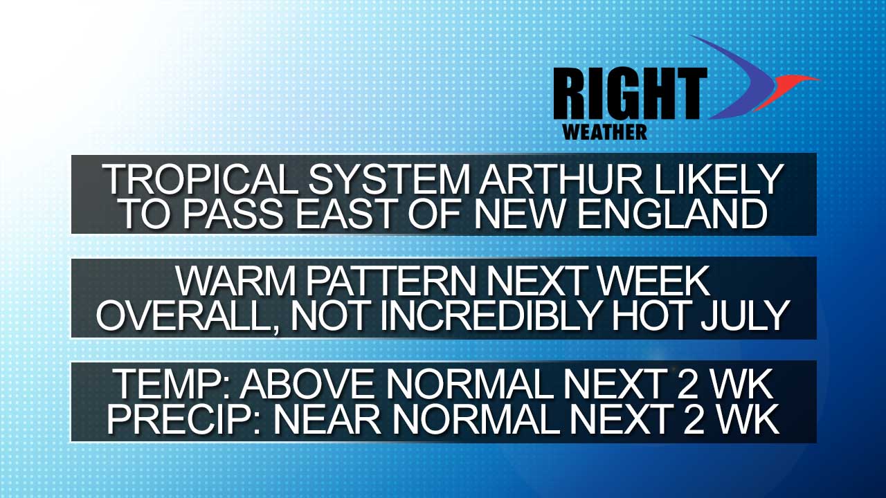
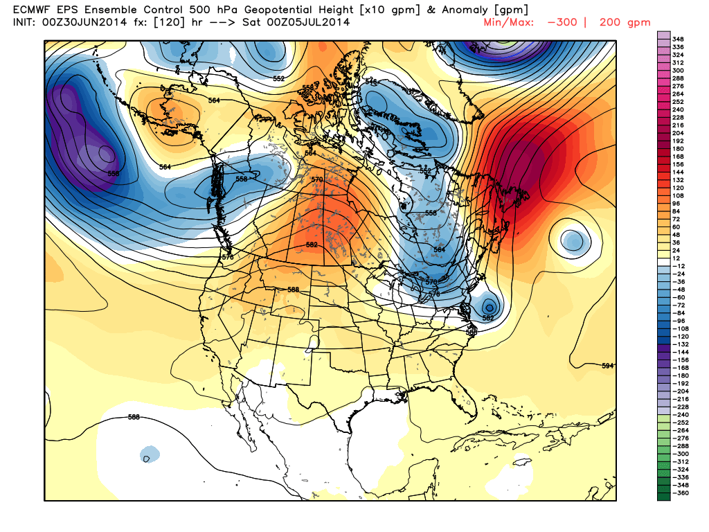
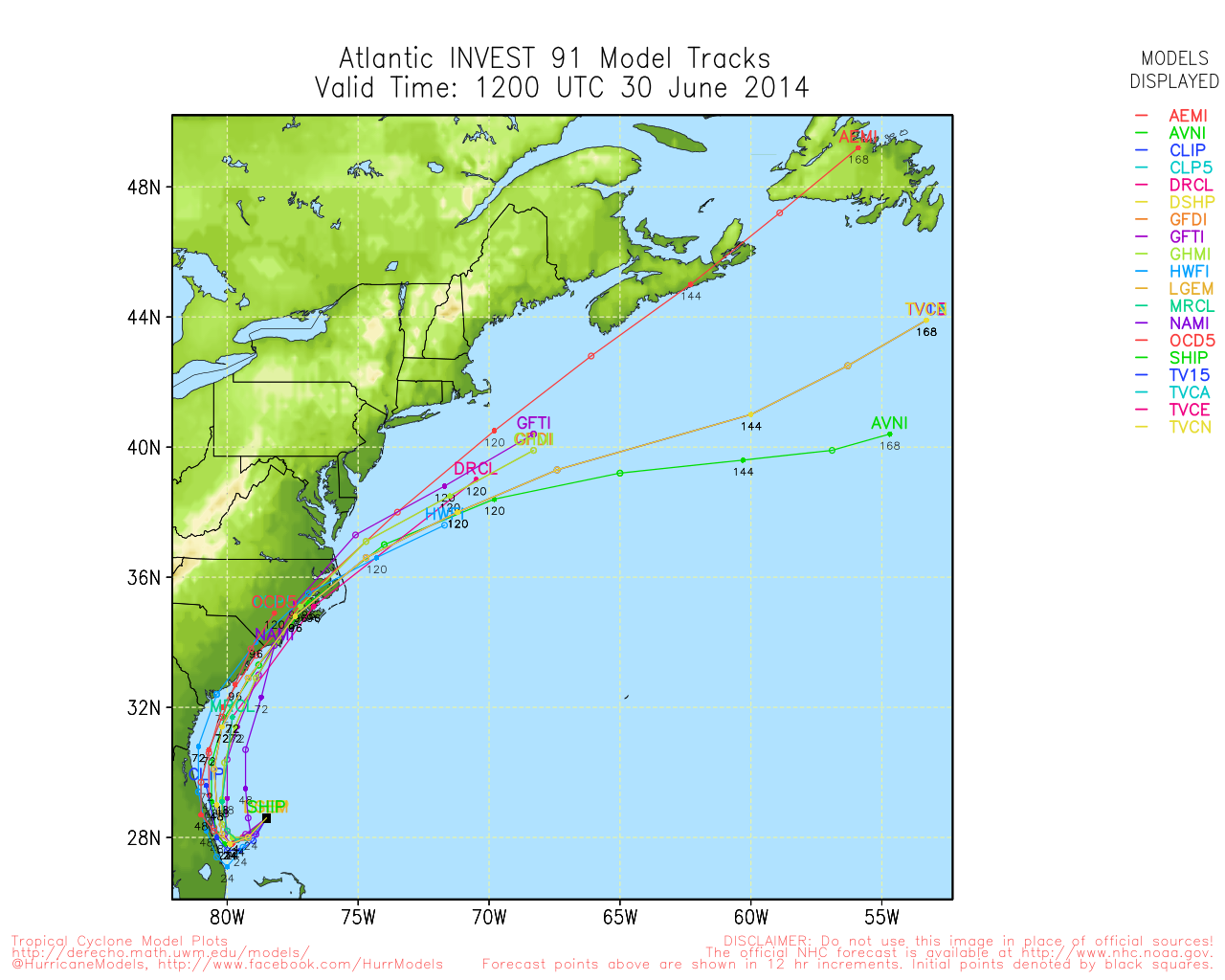
We’ll start with the potential for Tropical Storm (and possibly hurricane) Arthur to form off the Southeast US coast. The system is in the slow-cooker off the coast, and will probably not rapidly intensify Monday or Tuesday, but by Wednesday it could be a tropical storm. It looks like it will meander around off the Florida coast for a couple of days before a dip in the jet stream moving through the Great Lakes draws it north late in the week. At this point, we are not favoring a track that comes close enough to New England for a major impact, although that scenario cannot be completely ruled out. The trough that moves through the Northeast will likely be positive or neutral tilt, and that should be enough to usher the storm east of Nantucket. Tropical systems racing from Cape Hatteras to east of Nantucket usually garner some media attention, but have a minimal impact in New England. At this point, the best bet is for high seas and rough surf if a strong tropical storm or hurricane passes east of Nantucket. If the cold front that will steer the storm northeast interacts with it to the point of it becoming extratropical, then there could be some heavy rain in the northwest quadrant, and that may affect Eastern Massachusetts. The storm is expected to pass by sometime on Saturday. This is still a five-day forecast, and a lot can change. Stay tuned…
Warm Pattern Developing
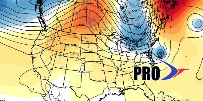
The prevailing weather pattern will evolve from one that resembles early to mid spring to something that is more summer-like. The first 90° day of the year is likely in the next couple of weeks, and there could be a few day stretch of hot weather if a ridge can hold along the East Coast without a front making headway into the Northeast. It still looks like there will be occasional disturbances in the jet stream that will prevent very long stretches of hot weather. The early outlook for July is for warmer than normal weather along the Eastern Seaboard, but cooler than normal in the Midwest. In this pattern, it would be tough to have searing heat in Southeastern New England for an extended period since our weather generally comes from west to east.
It has been dry of late, but there should be near to above normal rain in the next couple of weeks. Unfortunately, some of that rain will come around the 4th of July. There is a chance it will be enhanced and extended by the tropical system developing off the Southeast
coast.