Tropical Storm Arthur formed off the coast of Florida Tuesday morning, and it will likely clip Eastern North Carolina before heading out to sea and passing east of Nantucket early in the weekend. The storm could come close enough to bring heavy rain to Southeastern New England Friday into early Saturday. First, though, the hazy and humid weather will continue through the midweek.
Tuesday night will be partly cloudy with lows in the upper 60s to low 70s. Patchy fog is possible on the coast, Cape Cod, and islands. Any fog should burn off by mid-morning on Wednesday, and it will be hazy and very warm in the afternoon. Once again, there will be a 10-20 mph southwest wind. Highs will be near 90 in Boston, and in the upper 70s to low 80s on Cape Cod. There is a slight chance of a thunderstorm in the afternoon or evening.

Wednesday night looks partly cloudy with the chance of a shower or thunderstorm. It will be warm and humid. Lows will be in the low to mid 70s in the cities, and near 70 outside of the city. Patchy fog may develop, especially near the coast.
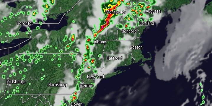
An approaching cold front will trigger scattered showers and thunderstorms on Thursday afternoon, primarily across Central and Western Massachusetts and Connecticut. There is a chance of t-storms in the i-95 corridor in the mid to late afternoon, but the greatest threat is west of the metro area. There is a lower chance of showers/storms in coastal RI and SE MA. Highs will be in the mid to upper 80s inland, and near 80 at the coast. Fireworks displays Thursday night may be affected by scattered showers/storms and patchy fog.
The front will pass through Southern New England on the 4th of July and help to steer Arthur, which may be a hurricane, out to sea. The best chance of rain on the 4th is south of the MA pike, but showers and thunderstorms cannot be ruled out in Boston. At this point, it does not look like a washout, and I would not recommend postponing outdoor plans yet. Arthur will likely pass well east of Nantucket Friday night. The best chance of seeing a period of heavy rain and 20-30 mph winds is on Cape Cod and the islands late Friday night. The storm will likely race to the northeast, and may be completely out of the picture by early Saturday morning.
The weekend is shaping up to be very nice, with lots of sunshine and seasonably warm conditions. Highs will be in the low 80s on Saturday, and mid 80s on Sunday. It’ll be a bit cooler near the coast. It will not be terribly humid this weekend.


