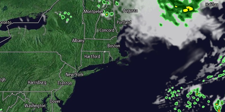
Moderate to heavy rain will continue through the evening in Rhode Island and Southeastern Massachusetts before ending from west to east after midnight. The epic rainstorm from a stalled cold front combined with moisture from Hurricane Arthur produced more than a half a foot of rain in Southeastern Massachusetts through early Friday evening. Rain totals of 2-5″ were common in Rhode Island. Final storm totals will likely be 3-5″ in most of RI and SE MA, with some places receiving 6-10″ – particularly along the South Coast. Flash flooding was happening in Southeastern Massachusetts early Friday evening, with more moderate to heavy rain yet to come.

The weather will take a very quick turn as Hurricane Arthur weakens to a tropical storm and accelerates away from Southern New England late Friday night. Skies will clear by dawn, and the wind will kick in out of the northwest bringing in drier weather for the weekend. The wind may gust over 40 mph on Cape Cod and the islands late Friday night. Wind gusts over 30 mph are possible near Buzzards Bay and the RI coast late at night and early Saturday morning.
Saturday will be windy in the morning, and breezy in the afternoon. Otherwise, it will be delightful with highs in the low to mid 80s and plenty of sunshine, but lower humidity then the past few days. Saturday night looks clear and comfortable, with a low near 60.
Sunday will also be a very nice day with highs in the mid to upper 80s inland, and low 80s near the coast. There will be a 10-20 mph southwesterly breeze in the afternoon.
High surf and dangerous rip currents are possible this weekend at area beaches. So, while the weather will be great for the beach on Saturday and Sunday, there could be certain areas that are off-limits to swimming – especially on Saturday.
Muggier weather arrives early next week. It will stay rain-free through Monday, but scattered showers and thunderstorms are possible Tuesday and Wednesday. Highs will be in the mid to upper 80s inland on Monday and Tuesday, and in the low to mid 80s on Wednesday. Lows will be in the mid to upper 60s.


