MORNING UPDATE
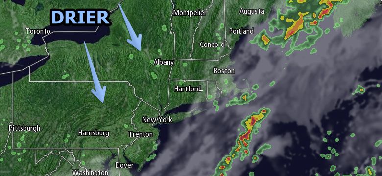
The cold front was moving offshore a little sooner than expected, and that means that Thursday will be drier and brighter than previously though. Showers and thunderstorms cannot be ruled out once there is some heating during the morning. The chance of showers continues in the afternoon. Skies will be partly sunny. It will turn less humid during the day, with highs in the upper 70s to low 80s.
FROM EARLIER
Wednesday was one of the warmest days of the year in Southern New England, and it may have felt like the warmest with the heat and humidity combined. The heat index was in the mid 90s inland during the afternoon even though the temperature struggled to get to 90 in most spots. An approaching cold front will send a line of strong to severe thunderstorms into western Southern New England Wednesday evening. The line will likely weaken some as it gets to Rhode Island and Southeastern Massachusetts after midnight. The temperature will stay in the upper 60s to low 70s with high humidity Wednesday night. Patchy fog is possible near the coast.

The cold front will move through the area slowly on Thursday. Showers and thunderstorms are possible, primarily in the morning. It will turn less humid late in the day as the wind swings around to the north-northeast. There may be some afternoon clearing from west to east. Highs will be in the upper 70s to low 80s.
Dry and pleasant weather is ahead for Friday. It will turn much less humid with mainly clear skies Thursday night. Lows will be near 60. Friday looks great, with a blend of clouds and sun, and highs in the upper 70s to low 80s. A sea breeze will develop in the afternoon. The weekend will begin with nice weather on Saturday before another weather system threatens Southern New England with showers and thunderstorms.
Saturday will be partly to mostly sunny with highs in the low to mid 80s. It will turn somewhat humid during the day. Overall, it looks like a nice beach day. Clouds will increase Saturday evening, and showers/t-storms are possible after midnight Saturday night. Scattered showers and storms are possible on Sunday with partly to mostly cloudy skies. Highs will be in the upper 70s near the coast to mid 80s inland – if there is enough sunshine. It looks unsettled early next week, with scattered showers/storms possible on Monday.


