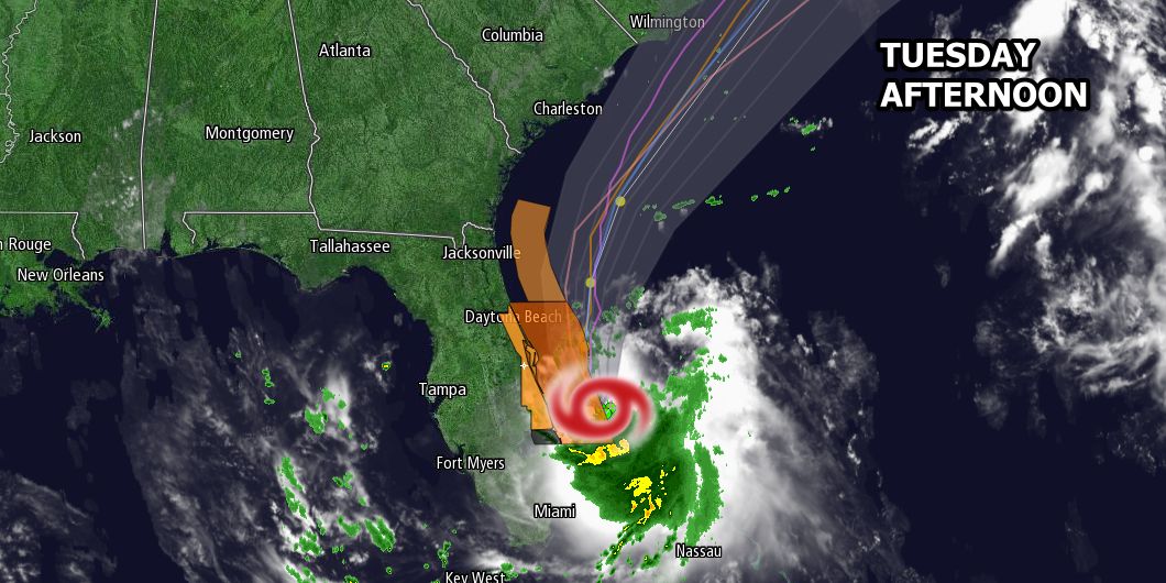
The first tropical storm of the Atlantic hurricane season has formed off the Florida coast. The National Hurricane Center says Tropical Storm Arthur has winds of 40 mph as it moves northwest at 2 mph 95 miles southeast of Cape Canaveral.

The storm is expected to move north and then northeast, possibly hitting the North Carolina Outer Banks before moving out to sea east of Nantucket. The storm is forecast to strengthen to a hurricane as it nears the Outer Banks, and may still be a hurricane as it moves well east of Nantucket.
An approaching cold front will help to steer Arthur out to sea, and that front combined with some tropical moisture may lead to occasional showers and thunderstorms on Thursday through Friday. If you have outdoor plans for the 4th, stay tuned to the forecast because it’s unclear at this point if it will be a washout or just a few showers. It depends on the speed and track of Arthur along with the progression of the cold front.
There is a less than 20% chance of tropical storm force (40 mph) winds in Rhode Island and near Buzzards Bay, and a 20-32% of tropical storm winds on Cape Cod and the islands. Nantucket has the best chance of experiencing 40+ mph winds.
You can track the storm here: http://bit.ly/hurricane-track


