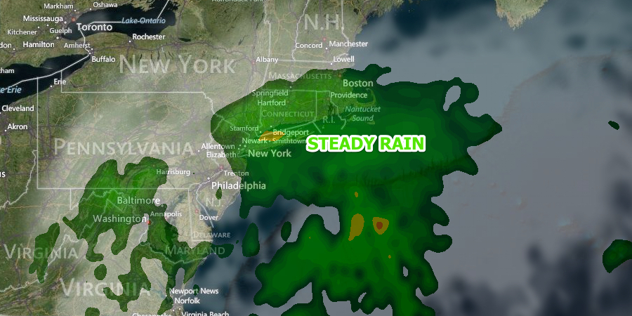
Increasing Likelihood of Rain Thursday

A developing storm system that we have watched closely over the past couple of days will likely come close enough to bring steady rain to Southeastern New England on Thursday. The storm is developing along the Southeastern United States coast and it will creep up the coast on Wednesday before arriving with rain late Wednesday night and Thursday.

Wednesday should be a decent day, with some sunshine followed by increasing clouds, and highs near 70 after a morning low temperature in the 40s. Clouds will thicken Wednesday night, and rain is possible, especially near the coast, by early Thursday morning. Lows will be in the 50s. Thursday looks rainy with highs only in the low 60s. There will be a 10-15 mph east-northeast breeze as the storm moves south of Block Island. Showers will likely continue Thursday night into early Friday before the storm drifts out to sea. Lows will be in the 50s Thursday night. If the storm tracks close enough to the coast, then more than a half-inch of rain is likely – a welcome soaking and about as much rain as many places have seen so far this month.
After a murky start, the sky should brighten Friday afternoon. It will be seasonable with highs in the upper 60s to low 70s. The best chance of sunshine is away from the coast. It still looks like there will be plenty of sunshine and rather warm conditions this weekend. Both Saturday and Sunday should be mainly clear with highs in the upper 70s to low 80s inland, and low 70s near the coast. Lows will be in the 50s.


