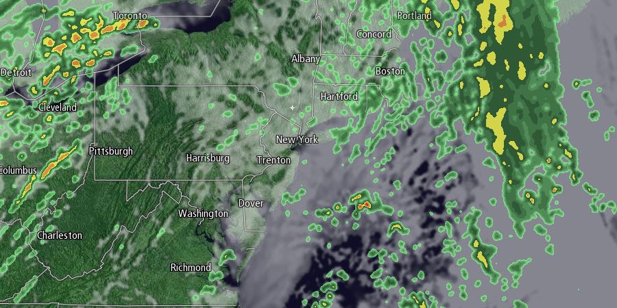
Thanksgiving week will begin with a rainstorm Monday morning. Rain, and possibly even a thunderstorm, is likely Monday morning as a storm system cuts well to the west of New England. There will be a gusty southerly wind, which will help the temperature get into the low to mid 60s. The wind may gust over 40 mph through midday on Monday. Steady rain will end by noon or shortly after, and it will stay cloudy, damp and mild through the day. It looks like most places will receive 0.5-0.75″ of rain.

It will be mostly cloudy and relatively mild Monday night. Lows will be near 50. Tuesday looks like the nicest day of the week. You can expect partly sunny skies with highs in the mid 50s. The temperature will dip into the mid 30s with mainly clear skies Tuesday night.
A storm is likely in the midweek, and it could have an impact on the pre-Thanksgiving travel in the Northeast. The exact track of the storm is uncertain, but we are favoring a track that brings the center of the storm close enough to allow for mainly or all rain in Rhode Island and Southeastern Massachusetts. Based on that track, the primary snow threat is in Western Massachusetts and Connecticut. The rain may be heavy at times Wednesday afternoon and night as the storm moves up the coast. It will be raw, with temperatures only in the upper 30s to mid 40s. Strong winds are possible, especially near the coast, as the storm intensifies.
Rain and/or snow will likely end by early Thursday morning. At this point, it looks like the temperature will be above freezing, and icy roads would not be a concern for anyone travelling on Thanksgiving morning. It will be partly cloudy and breezy in the afternoon. The temperature will hover near 40.
The early outlook for Black Friday into next weekend is for cold and mainly dry weather. Highs will only be in the 30s, and lows will be in the upper teens to mid 20s.


