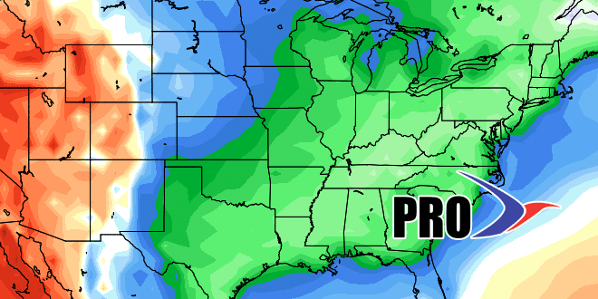
The latest visit from the Polar Vortex to the United States is just around the corner. It’s sure to make many national headlines next week, but the biggest impact will not be in Southeastern New England. It’s sure to be much colder (relative to normal) in the Midwest and parts of the Southeast than it will be in RI and MA. That’s not to say it will not be chilly, because it will, it just will not be as cold as it will be to our west.
There may be a few midweek showers next week as the colder air arrives on Wednesday or Wednesday night. Thursday into Friday look like the coldest of the season so far, with highs only in the low 40s, and lows in the 20s to low 30s. We’re keeping our eye on the potential for a storm in coastal New England heading into next weekend. The pattern favors something coming out of the southern branch of the jet stream, the question is whether it can come far enough north to reach SNE before heading out to sea.
The pattern does not look as cold in the eastern United States after the end of next week, but it will still likely be near to slightly below normal. Overall, aside from the potential storm threat early next weekend, it does not look like a particularly wet pattern, either. See the video for more.


