It looks like Santa will be riding his sleigh on a strong southeasterly wind Christmas Eve in Southeastern New England. A strong storm will cut west of New England, and we’ll be on the mild side of it with rain heavy at times, and the chance of a thunderstorm Wednesday afternoon and evening. The rain may end by late in the evening, and it will mostly likely be long gone by Christmas morning. The temperature will spike into the 50s to low 60s due to the strong southeasterly winds which may cause damage – especially near the coast.
It will turn cooler on Christmas, but we do not expect it to be very cold. Highs will be in the 40s. There will be a gusty westerly wind on Thursday. Depending on the track of the storm, there could be snow showers in Northern New England, but it will most likely stay dry in Southern New England.
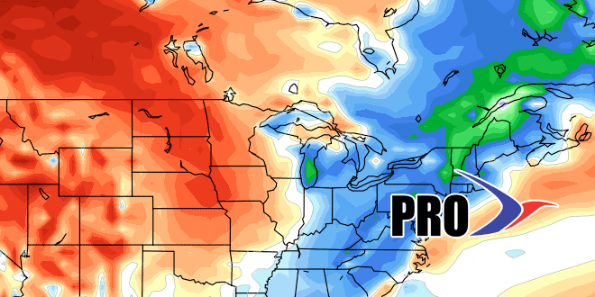
The stormy pattern may yield another rainmaker into next weekend. While it’s relatively mild in the Eastern United States, it will be turning much colder out West. The cold weather will gradually move east late in the year and into the new year. At this point, it looks like it could get here by New Year’s Eve. Eventually, as the pattern evolves, there will be snow threats, but that may not happen until around or just after the New Year.
Overall, we’re looking at December going in the books as mild, wet, and possibly among the least snowiest on record in the Providence area. For snow lovers, it looks like there is hope for a different pattern change in early January.


