The weather pattern this week will be dominated by the slow-moving storm that will bring strong winds and heavy rain on Tuesday. While the storm will not be nearly as fierce Wednesday and Thursday, it will still be close enough for scattered rain showers on Wednesday, and rain or snow showers on Thursday. In fact, it may not be until midday Saturday before the storm finally moves offshore and high pressure begins to move in from the west. The weekend looks relatively quiet, with highs in the 40s.
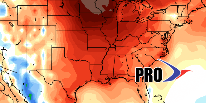
Looking ahead to next week, the odds favor fairly quiet weather. A developing system will probably stay far enough south and east of New England that it does not bring substantial snow/rain in the midweek. Overall, it looks like the storm track will be suppressed to the south, and the weather over New England will be warmer than normal, but not as warm as the Midwest. If the midweek storm next week stays south, than there could be a 8-10 day stretch of dry and seasonably mild weather to take us to around December 20-22. There are still signs that it will turn colder and stormier after Christmas through the New Year.


