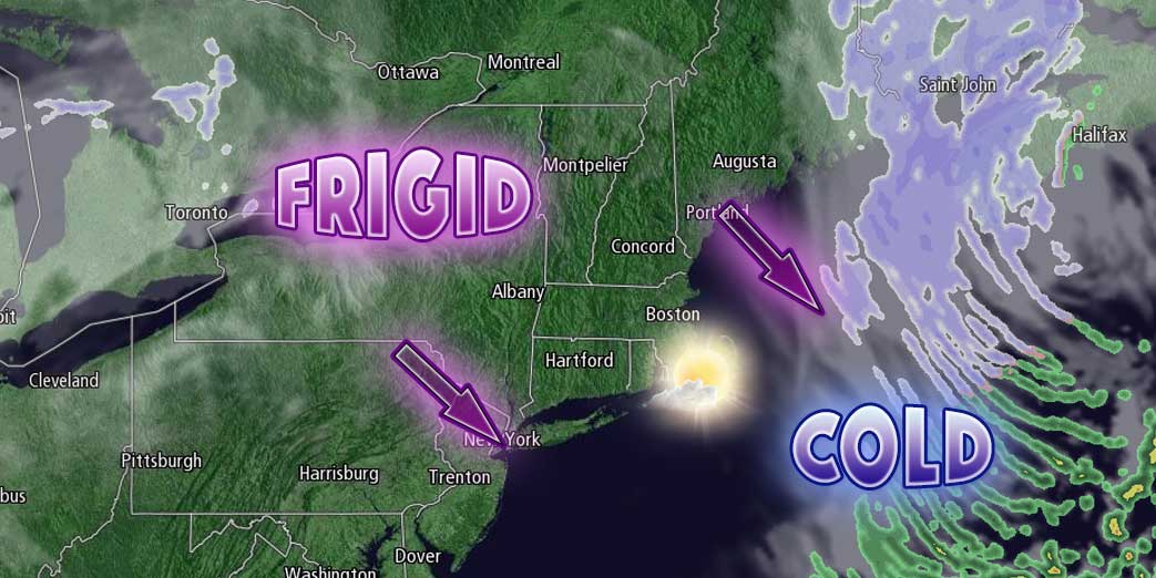
There are two potentially impactful weather events ahead in the next few days. The first one is not so obvious, the second one is not hard to pick out. The first thing to be concerned about is a flash-freeze Friday evening as much colder weather arrives on a gusty northwest wind. Snow showers and flurries all day Friday, combined with a little melting snow and ice, has left roadways, driveways and sidewalks wet, and the quick temperature drop may be enough to freeze the water before it dries. Icy travel is possible on untreated surfaces Friday night.

The temperature will plummet into the single digits to low teens by dawn on Saturday. The gusty 15-35 mph northwest wind will drop wind chills to about -5° to -20°early in the day. A storm will develop east of New England, and it will throw some snow showers and flurries back into Southeastern New England. Right now, it does not look like there will be any accumulation in RI, and possibly a coating to an inch in Eastern Massachusetts. Friday afternoon will be partly to mostly sunny and bitter cold. Highs will be in the teens with a 15-30 mph northwest wind.
It will be clear and frigid Saturday night. The temperature will fall into the single digits again by dawn on Sunday. Super Bowl Sunday looks mostly sunny and very cold with highs in the low to mid 20s.
Another Snow Storm Ahead
Clouds will thicken Sunday evening, and snow is likely sometime after midnight and before dawn on Monday. The snow will stick immediately, and a moderate to low-end major snow storm is possible for most of Southern New England. There could be a couple of inches of accumulation before the morning commute, and snow will continue piling up during the day into Monday evening.
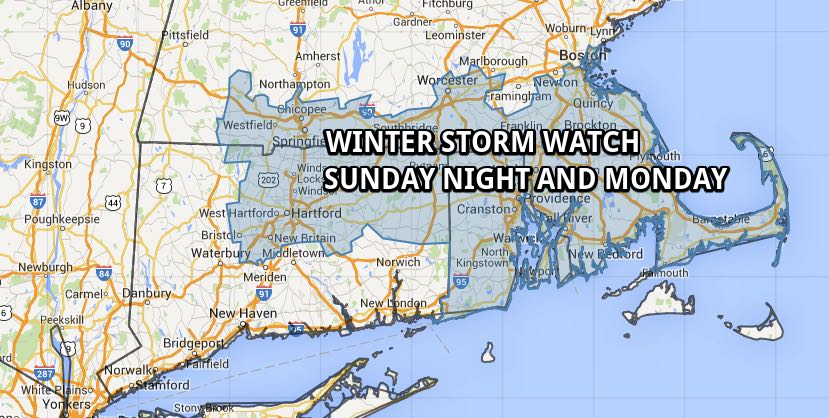
The National Weather Service has issued a Winter Storm Watch for most of RI and SE MA. Six inches or more of snow is possible. The exact track of the storm is questionable, and it’s a bit early to say if it will be a light, fluffy snow or wet and heavy. At this point, we’re leaning toward a track that leads to mainly light/fluffy snow in Southern New England. Temperature will climb out of the teens into the 20s on Monday. The wind will increase to 15-30 mph during the day, and some stronger gusts are likely as the storm pulls away Monday evening and the snow ends. The temperature will plunge into the single digits by early Tuesday. We will keep you posted on this storm all weekend. The weather looks very cold and dry in the middle of next week.


