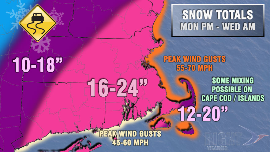
Here is a first look at our snow forecast for the potentially historic blizzard in Southern New England. It is certainly unusual to have a 16″ low-end of the snowfall range, but this storm warrants it. It is very unlikely that there will be less than 10″ of snow in Rhode Island and Southeastern Massachusetts, and many computer models are projecting an average of 20″ for most of the area. To put that in perspective, there have only been three storms since 1905 with 20″ or more in the Providence area.
We will have a detailed timeline later Sunday, but the gist of it is snow developing Monday afternoon, with the worst of it Monday night into Tuesday morning. Snow will linger into Tuesday night. Winds will howl, and blizzard conditions are possible.