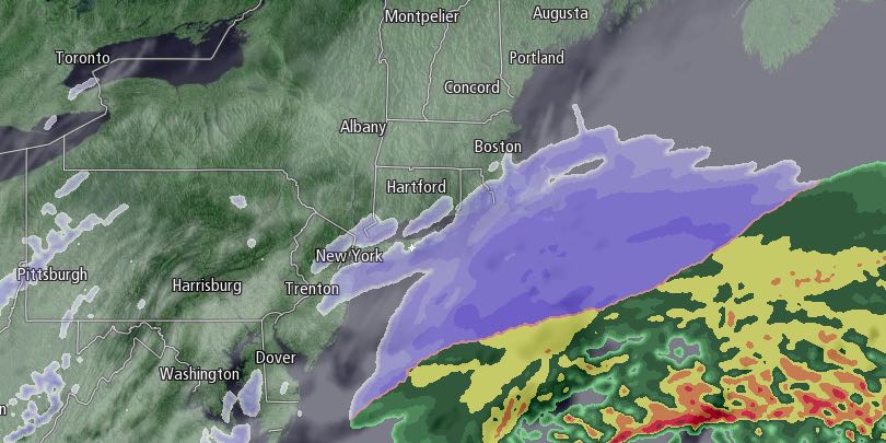
The February snowfall record was set in Providence before dawn on Wednesday. This month eclipsed 1962 as the snowiest February on record with 31.6″ of snow…and counting. There are still a few days to go before the month ends, and a storm moving south of Southern New England may send more flakes flying on Thursday. The snow should be relatively light, and steadiest near the coast. The light snow, combined with stronger late-February sun angle should not accumulate too well on paved surfaces. The snow threat is from mid-morning (8-10 am) until mid-afternoon (2-4 pm), and less than an inch is expected. The islands actually have the best chance of seeing steadier snow and picking up 1-3″.

The storm will move away late Thursday and be followed by none other than more dry and cold weather. The temperature will be in the 20s on Thursday, singled digits to teens Thursday night as skies clear, and in the 20s again on Friday with plenty of sunshine. It will feel colder Thursday night and Friday because of a 10-15 mph northwest breeze. The wind will relax Friday night, and if skies are clear, the temperature could plummet to below zero in the countryside and single digits in the cities and near the coast.
The weekend will begin with chilly sunshine on Saturday. Highs will be near 30, and that will extend a stretch of below normal days since January 26 into, at least, the first day of March. Clouds will increase late Sunday, and snow is possible around sunset. Sunday night will feature snow and/or rain in Southern New England. It should not be a huge storm, but some snow accumulation is possible. There will be a little break Monday into Tuesday before another storm threatens in the midweek.


