AnalysisMobile

Live Blog: Latest on Weekend Storm

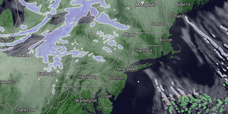
A mainly clear and frigid Friday and Friday night will give way to increasing clouds Saturday morning as a strong disturbance approaches from the west. The storm will bring snow by late Saturday afternoon, and it will continue into the night. A storm will develop quickly east of New England, and the weather may get worse on Sunday with snow and strong winds on the backside of the storm as it slowly moves away. Fred Campagna has the latest on the forecast on Friday, February 13 in this Live Blog.

Fred Campagna

President and Chief Meteorologist - Right Weather LLC AMS Certified Consulting Meteorologist #756 AMS Certified Broadcast Meteorologist #126

Related Articles

11 Comments

  1. Fred I can’t see some of the charts, they flash on and then go out, could you please check it out? Thanks Steve

    1. Stephen, what browser are you using? We have not had anyone reporting similar issues. I checked it out in Chrome, Safari, and Internet Explorer, and it looks fine.

      1. You can add Mozilla Firefox to the ok list. Stephen, make sure your flash is up to date as well as browser version.

  2. It sadly looks as though Cumberland is in that 8-12″ range as well as Eastern MA! I assume that means we are in the 8″ part?

  3. Fred, as someone that has to travel to NY this weekend. The trip there will be very early Sat morning so little impact expected there. The ride back is around 3PM Sun. How rough will the conditions be traveling back at that time? What should expectations be? Thank you

    1. When it is colder, the snowflakes that form can stack up in such a way that the same amount of water gives you more snow depth than if it were a wet and heavy snow. We expect this storm to fluff up a bit, yielding deeper snow than we normally get from the amount of water the storm will produce. For instance, this storm may produce 7-8″ of snow out of the liquid equivalent that normally brings about 5″ of snow.

  4. Is this forecast relatively set in stone, or is there still a shot the storm moves farther inland and moves slower??? And how treacherous is the traveling supposed to be Saturday night? Possibly traveling from Mansfield to North Tiverton on Saturday night, but if its already going to be cranking up around 8 on Saturday, we may have to cancel plans. Thanks for all you do Fred! 🙂

    1. The Saturday evening part of the forecast is pretty straightforward. It will be snowing, and 3-4″ will likely accumulate by late in the evening. The questions with the forecast surround late Saturday night and Sunday morning with how much snow will wraparound the rapidly developing storm. It will not be windy Saturday evening.

Back to top button