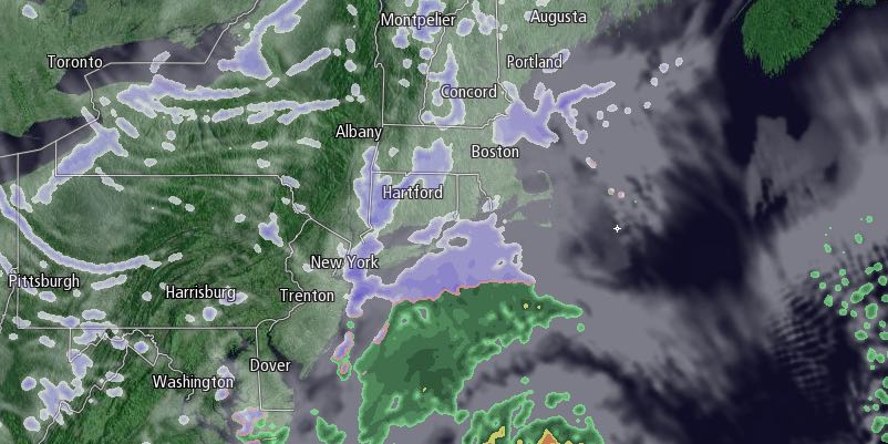
A weak system will move through Southern New England on Thursday, and a storm will develop in the Atlantic Ocean. The storm will be far enough away that RI and SE MA receive just a glancing blow with light snow and snow showers Thursday into Thursday night. The snow threat will likely end in RI and interior SE MA around midnight, and it will end before dawn Friday on Cape Cod and the islands. Highs will be in the mid to upper 20s on Friday. Snow totals will range from around an inch in most spots to 1-2″ near Buzzards Bay and upper Cape Cod, and possibly 3-4″ on Nantucket and lower Cape Cod.

It will become windy and turn even colder Thursday night as the storm moves away from the coast. The temperature will fall into the single digits by dawn on Friday, and wind chills will be below zero. Highs will only be in the low teens on Friday with partly cloudy skies. Wind chills will stay near zero.
Friday night looks frigid, with lows a few degrees below zero inland, and slightly above zero near the coast under mainly clear to partly cloudy skies. A stronger jet stream disturbance will arrive on Saturday, and it will spawn a storm in the Atlantic Ocean not too far from the coast. Exactly where the storm forms will decide whether Southeastern New England has a light to moderate snowstorm or another major storm with near-blizzard conditions. Right now, we are bracing for another significant weather event with the latest trends bringing the intensifying storm closer to the coast.
Snow will develop during the day on Saturday, and it may be heavy at times in part or all of Southeastern New England Saturday night into Sunday morning. Highs will only be in the teens to low 20s, and it will turn colder Saturday night into Sunday. The wind will increase out of the north-northeast, and wind chills will fall below zero. Snow will wind down during the day on Sunday, but it will stay windy, and get colder Sunday night into Monday morning. The temperature may fall below zero again Monday morning, and dangerous wind chills are possible.
It’s too early to speculate about specific snow totals for RI and SE MA, but there is a decent chance of 6″, and a foot of snow is possible if the storm develops close enough to the coast.
After a frigid start to next week, yet another storm will make a run at Southern New England with snow or a wintry mix in the midweek.


