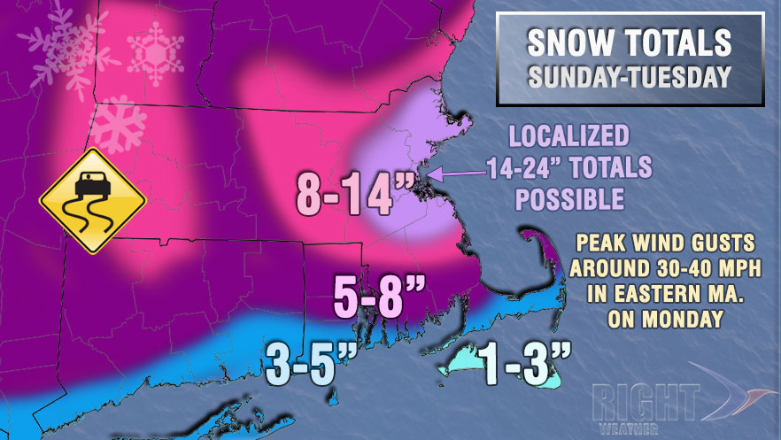
The hits keep coming for Southern New England. An all-time snowy stretch continues with a moderate to locally heavy snowstorm for Rhode Island and Eastern Massachusetts lasting into early Tuesday. The jackpot will likely be in Eastern Massachusetts near Boston, but plowable snow is likely in most of Southern New England. Steady snow is likely Sunday night with 3-7″ of snow accumulating by dawn. Most of Rhode Island and Southeastern Massachusetts should see 3-4″ overnight, with 4-7″ accumulating near Boston. It’s possible there could be some narrow heavier bands of snow between the North Shore and South Shore that lead to locally higher amounts.

The storm will continue on Monday, and, once again, the best chance of seeing the snow really pile up is in the Boston Metro area. There will be accumulation in Rhode Island and Southeastern Massachusetts, but probably not more than 2-4″ during the day. See the map below for snowfall totals from Sunday night to the end of the storm late Monday night. Highs will be in the upper 20s to low 30s on Monday.
The snow will end by dawn on Tuesday, and it will be partly to mostly cloudy with highs in the upper 20s. The weather will stay quiet through Wednesday before another storm threatens with light to moderate snow Thursday into Thursday night. Right now, it does not look like a major storm. A few inches are possible as an Alberta Clipper develops south of Southern New England.
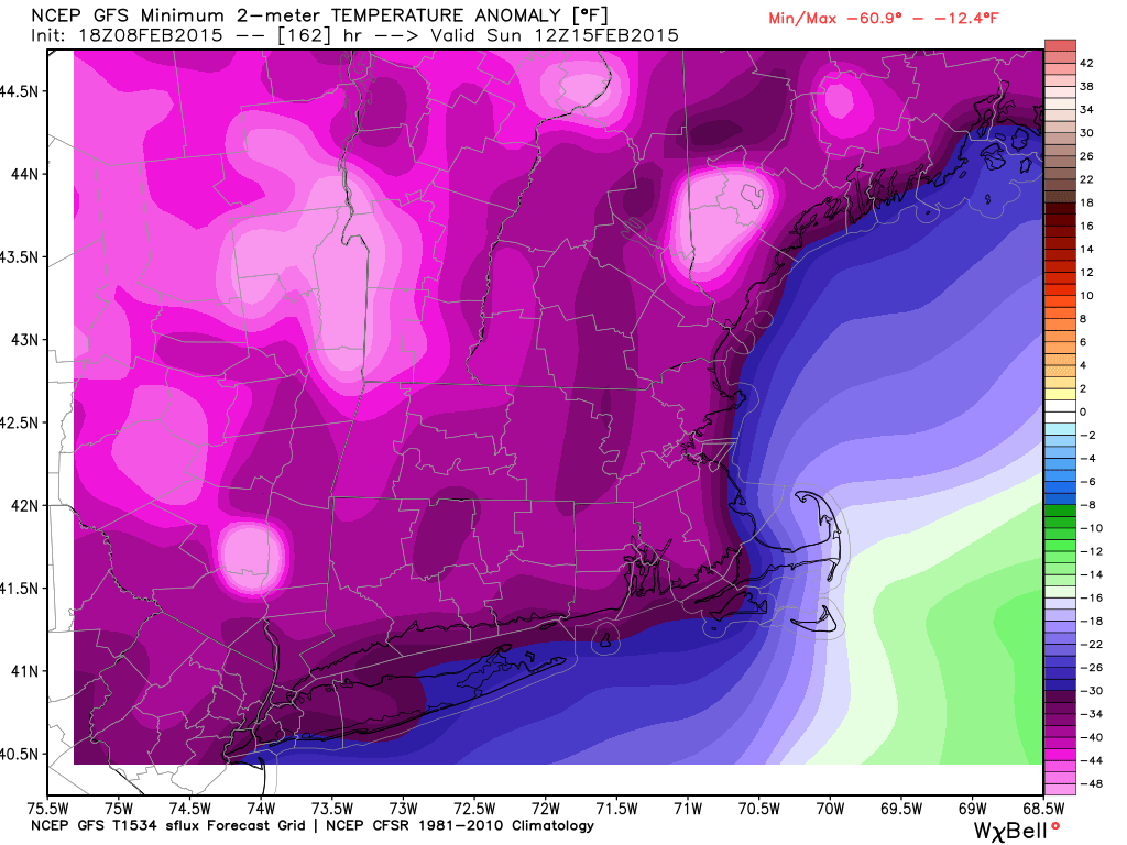
Even with the snow in the forecast, the most extreme weather in the next seven days may come next weekend when some of the coldest weather in decades may arrive in Southern New England. Temperatures could fall well below zero Saturday and/or Sunday morning, and highs one of those days may not reach 10° in some spots. The temperature may be 30-35° colder than normal for mid-February!