March is running 6.6° colder than normal in Providence, and that includes the recent mild stretch. There is more relatively cold weather ahead, and it’s likely that by the end of the month, January-March will be one of the coldest (relative to normal) three-month stretches on record in Southeastern New England. Of course, as we get closer to spring, the cold snaps do not have the bite that they did in February. A normal high of 50° is only 10 days away.
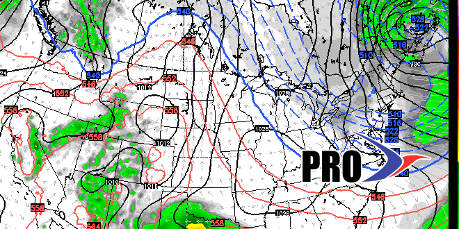
After a relatively cool and quiet end to the workweek, a storm system this weekend will bring mainly rain. A few flakes or ice pellets are possible at the beginning of the storm on Saturday morning, but it will change to rain and the temperature should reach 40°. There will be a period of steady rain, but widespread flooding is not expected. The storm will move away on Sunday, and rain showers may change to snow showers during the day, but there is unlikely to be any accumulation because of the high sun angle and temperature near or slightly below freezing. Snow could accumulate if it starts before dawn or ends after sunset, but, right now that’s not expected.
The weather will be quiet again early next week before a cold front brings rain and snow showers early Tuesday morning. It will be chilly behind that front, and dry/cool weather is likely for most of next workweek. Looking ahead to next weekend and beyond, the pattern should yield some precipitation threats with a storm track most likely south of Southern New England. Spring begins next Friday, and there will probably be some snow after it begins. A lot of people have asked me “is it (winter) over?”, and the short answer is no. We may not get another blockbuster or even plowable snow, but there will be talk of snow after March 20.


