The temperature flirted with 50° on Monday afternoon in Southeastern New England. The mild conditions caused a lot of melting, and there will be some refreezing Monday night as the temperature falls into the mid to upper 20s. Watch out for some icy spots late tonight and early Tuesday.

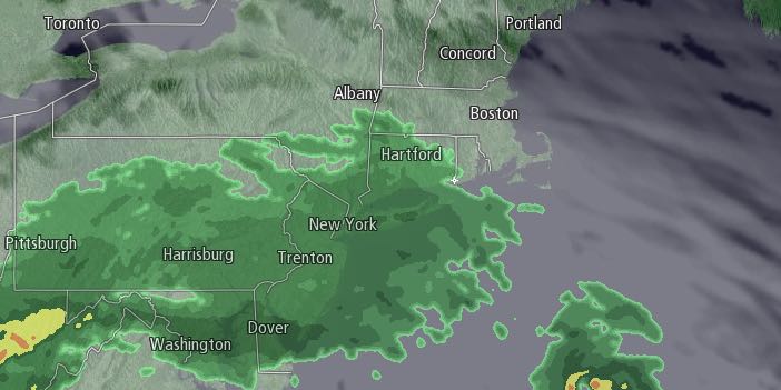
Tuesday will begin with sunshine, but clouds will increase in the afternoon. Highs will be in the low to mid 40s with a southerly breeze. It should stay dry until early evening before rain arrives from south to north during the evening. It does not look like a soaking rain, but showers are likely Tuesday night. The temperature will dip into the mid to upper 30s, but stay above freezing.
Any rain will end by dawn on Wednesday, and there should be some sunshine during the day. A mild west to northwest wind will help the temperature reach at least the mid 40s, and possibly as high as the mid 50s. A cold front will move through Wednesday night, and the temperature will settle back into the 30s at night. Thursday looks partly sunny and windy, with highs near 40.
It will be cold Thursday night into Friday. Lows will be near 20 on Friday morning, and highs will be in the 30s, even with a lot of sunshine. A storm is in the forecast for this weekend. The early outlook continues to be for snow/mix changing to rain on Saturday. The storm may linger with rain/snow showers on Sunday. Highs will be in the 30s to low 40s on Saturday, and 30s on Sunday.


