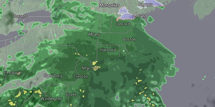
A storm system will bring steady rain to Southern New England on Saturday. The precipitation may start as a brief period of freezing rain inland around dawn before quickly changing to rain. It will likely start as rain in most of RI and SE MA. The temperature will climb into the upper 30s to low 40s during the day. There will be 0.5-1.0″ of rain, with the steadiest rain likely from mid to late morning through mid to late afternoon. Widespread flooding is not expected. There could be some localized flooding near ice-clogged storm drains.

The temperature will hover in the upper 30s to low 40s with patchy fog and a few showers possible Saturday night. Colder weather will arrive on Sunday. There may be some lingering rain and snow showers, but the precipitation is not likely to be as steady as it will be on Saturday. The temperature will fall through the 30s. No snow accumulation is expected.
The threat of snow showers diminishes Sunday night, and the temperature will fall into the 20s by dawn on Monday. Look for mostly sunny skies on Monday. Highs will be in the 40s. A cold front will move through with the chance of rain showers on Tuesday morning. Highs will be in the 40s before the temperature plummets late in the day. It may fall all the way into the teens by early Wednesday morning. The weather looks quiet, but cold, in the middle of next week. Highs will be in the 30s on Wednesday and Thursday with partly to mostly sunny skies. Lows will be in the teens to low 20s – rather cold for mid March.


