Through Monday, rain totals were running at about 10% of normal in the last month in Southeastern New England. Showers on Tuesday morning provided some spots with more than 0.25″ of rain. After those showers, we’ll be back in a mainly dry pattern for the rest of the workweek and through most or all the Memorial Day weekend. There are two systems that could bring showers in that time frame. The first is on Friday as a storm slides out to sea south of Southern New England. At this point, it looks like it will stay away. There is also the possibility of showers on Memorial Day if a backdoor cold front slides far enough south and a wave of low pressure rides along it. This could happen, but there are about equal odds that it stays north of SNE and the weather stays fair and warm on Monday.
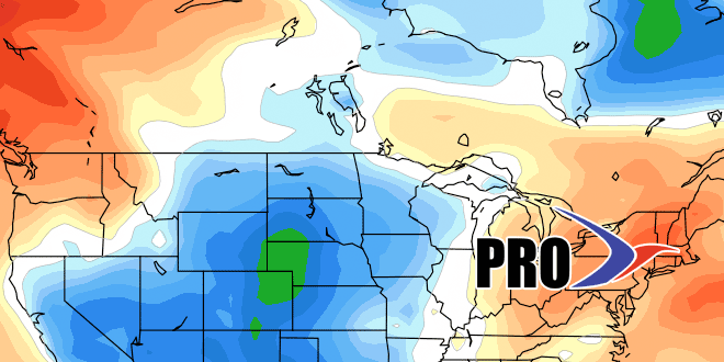
A system coming through in the middle of next week will threaten with showers. After that, the pattern gets tricky – as they often do when we’re transitioning from spring to summer. From my perspective, it looks like a mild to warmer than normal pattern with a better chance of some rain in late May and early June. The pattern looks fairly progressive, which means no extended warm/cold stretches, and probably a rain threat every 3-4 days.