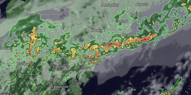
Sunday looks like an unsettled day in Southeastern New England. The morning looks partly to mostly cloudy, warm, and humid. A few showers cannot be ruled out, but we do not expect widespread rain before noon. There will be a 10-15 mph southwest breeze.

There is a better chance of rain in the afternoon as a cold front sags south through New England. Showers and thunderstorms could be locally heavy in the afternoon and evening. We expect the heaviest showers to be in Northern RI and northern Bristol County Massachusetts. Some poor-drainage street flooding is possible. Highs will be in the 70s before the rain begins. Once the wind shifts to the northeast, the temperature will quickly fall through the 60s into the 50s.
The northeast wind will continue for a couple of days. Look for plenty of clouds on Monday and Tuesday. There will likely be rainy periods, but, at this point, the timing of the steady rain is uncertain. Highs will be in the 50s to low 60s. Lows will be in the low 50s. The northeast wind will be 10-20 mph.
Skies will clear on Wednesday, and the temperature will approach 70 in the afternoon. The warm-up continues through the end of the workweek. Highs may be in the 80s inland again by Friday. It will not be humid Wednesday or Thursday. Muggy weather will gradually return late in the workweek and into next weekend.


