Showery and Cool Start to June

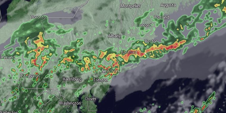
Flooding rain affected areas away from the coast in Southeastern New England on Sunday afternoon and evening. A break in the action is likely after midnight, but it will stay cloudy, cool, and damp, with temperatures in the low 50s.

More showers are likely on Monday. The best chance of rain is in the afternoon and evening. It will be unseasonably cool, with highs in the mid 50s. There will be a 10-20 mph northeast breeze.
Occasional rain will continue Monday night into Tuesday morning. Temperatures will hover near 50, with a persistent northeast breeze. Rain will wind down Tuesday afternoon. Clouds will be stubborn through the day. Highs will only be 55-60 on Tuesday.
Three-day rain totals of 1-5″ are likely, with the highest totals in Kent and Providence County in RI – the same areas that received 1-3″ of rain on Sunday. So, between Monday and Tuesday, there will likely be an extra 0.5-2″ of rain throughout Southeastern New England.
Wednesday looks partly sunny and still a bit cool for early June. Highs will be in the mid to upper 60s. It will be in the 70s with sun and clouds on Thursday. The humidity will stay low Wednesday into Thursday. Friday looks like the warmest day of the week, with highs near 80 inland. A cold front may trigger showers and thunderstorms on Saturday. Highs will be in the 70s. Next Sunday looks dry and seasonably cool. Highs will be in the low 70s.


