Meteorological spring wrapped up with locally heavy rain on Sunday. Even with the heavy rain in Providence, the spring was still drier than normal in Southeastern New England. Rainfall totals ranged from about 20-50% of normal between March 1 and May 31. March was much colder than normal, April was near normal, and May was warmer than normal. Averaged out, the spring was slightly cooler than normal in Southeastern New England.
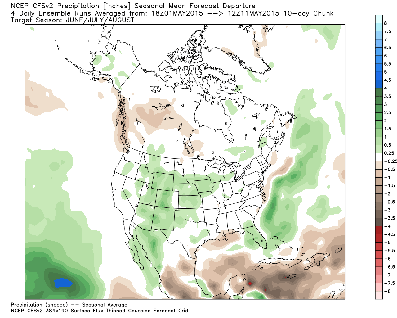
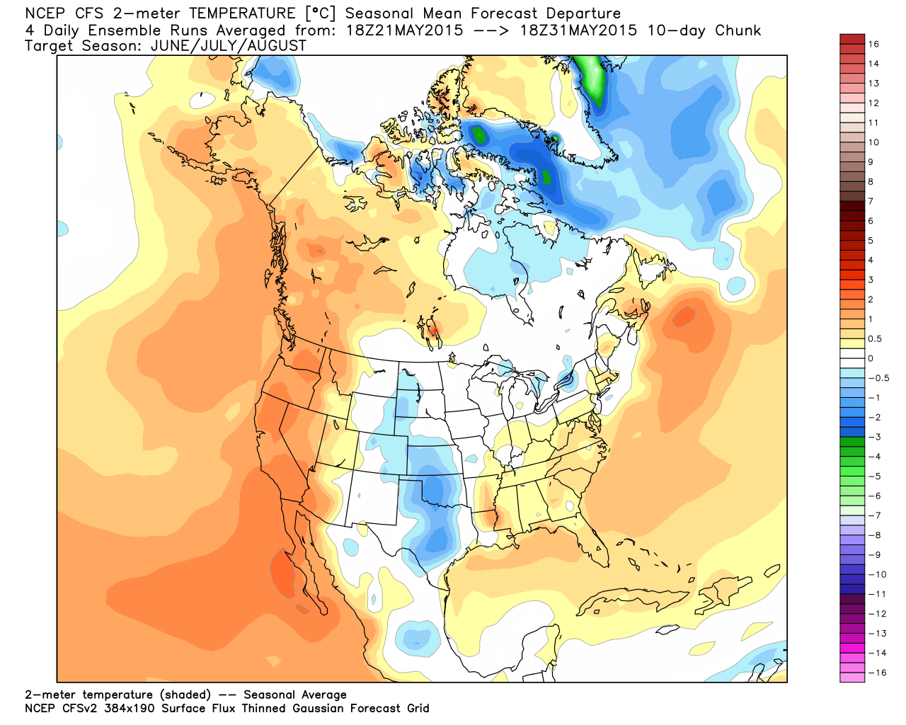
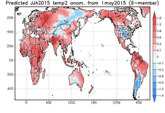
Looking ahead to summer, the consensus is for above normal precipitation and cooler than normal temperatures in the central United States. In this scenario, there would probably be trough in the Midwest, and a ridge along the East Coast. If that’s the prevailing pattern, then it will be a warmer than normal summer in Southeastern New England. However, that pattern does not lend itself to extreme heat in Southeastern New England. Typically, our hottest weather happens when it spreads in from the Midwest, instead of coming from the South. I am favoring a warmer than normal summer, but more of the warmth may come with above normal low temperatures instead of well above normal high temperatures. A persistent south and southwest wind will keep overnight temperatures mild with humid conditions in mid-summer.
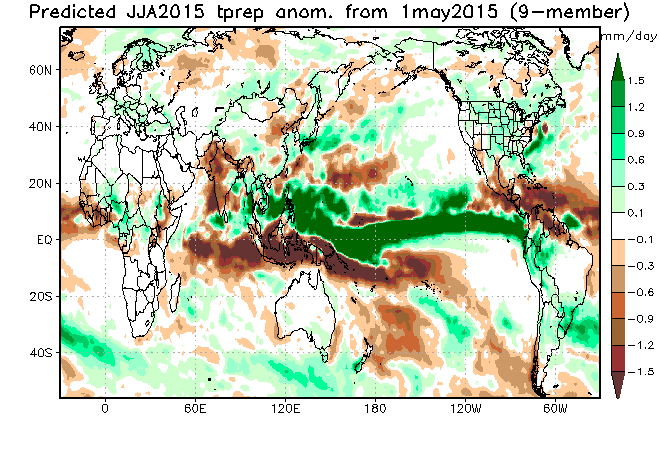
The dry spring pattern is already showing signs of breaking, and the rain that may head our way in the late-workweek could be a sign of things to come this summer. A disturbance off the Atlantic coast will drift north and bring a shower threat on Friday. Overall, I am looking for a wetter than normal June, with seasonably dry conditions in July and August. We should pull out of the moderate drought.
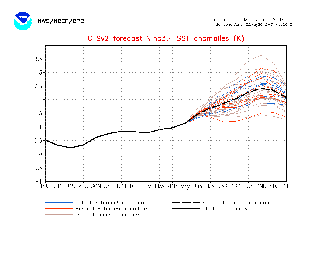
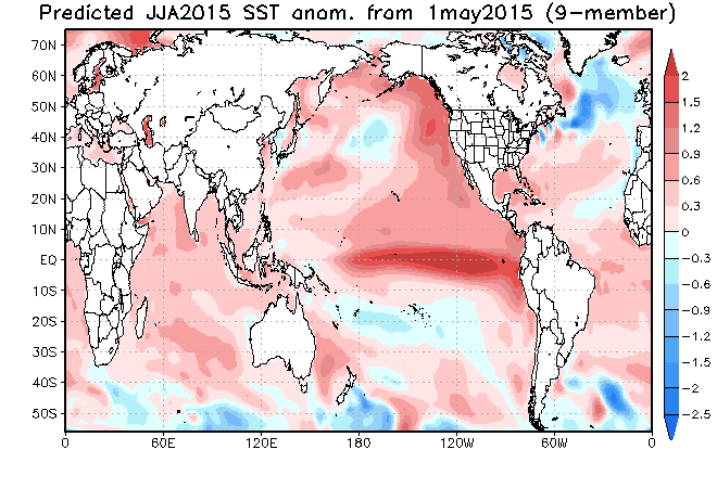
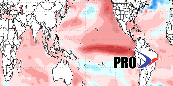
Regarding the hurricane season, a strong El Niño will tend to limit hurricane development in the Eastern Atlantic and Caribbean. The official NOAA hurricane season outlook calls for a 70% chance of a below normal season with 6-11 named storms, 3-6 hurricanes, and 0-2 major hurricanes. Of course, as we know, all it takes is one to have a major impact in our area. Warm water of the Eastern Seaboard combined with the prevailing jet stream pattern this summer could lead to more storms that develop close to the coast. While those storms may not have enough time to become monsters, they could lead to heavy rain and strong winds if they drift into the coast. The first storm of the season, Ana, formed in an area where it looks favorable for more action to happen during this hurricane season.
There has been a record gap between major hurricane strikes in the United States. Hurricane Wilma was the last major hurricane to strike the United States, hitting Florida in October, 2005 – over 3500 days ago. The current streak is more than 1200 days longer than the previous record. That’s not to say that the streak will end soon since each year is separate from the last. The idea that we are “due” for a major hurricane strike is simply not true.