The remnants of Tropical Storm Bill will bring a period of heavy rain to Southeastern New England Sunday morning. There will be scattered showers Saturday evening before steadier rain develops after midnight. The rain may be heavy at times late at night, and embedded thunderstorms are possible. Lows will be in the low to mid 60s as the tropical airmass moves in.

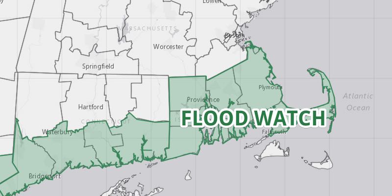
A Flood Watch is in effect Sunday in Rhode Island and most of Southeastern Massachusetts. Rain will be heavy at times Sunday morning. Rates of 1″+ per hour are possible, and there could be localized street flooding. The rain will taper to showers around midday, and most of the afternoon will be dry, although stray showers cannot be ruled out. Highs will be in the low to mid 70s with a few sunny breaks possible. Widespread 1″ rain totals are likely. Localized 2-3″ amounts are possible.
There is a slight chance of showers Sunday evening before skies clear after midnight. Lows will be in the 60s. Monday looks mostly sunny and warm. Highs will reach the low to mid 80s inland. It will be in the mid to upper 70s near the coast.
An approaching cold front could trigger scattered showers and thunderstorms on Tuesday. The best chance of rain is away from the coast. It will be mild and muggy, with highs near 80 inland, and in the 70s near the coast. Mainly clear and less humid weather arrives on Wednesday. Look for highs near 80 with mostly sunny skies. Thursday will stay dry before another storm system threatens with rain on Friday.


