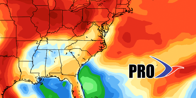
It’s hard to believe that we are already more than two weeks into June and the 4th of July is right around the corner. Monday was a setback weather-wise, but we needed the rain in Southeastern New England. It looks like we’ll get back to warmer weather on Tuesday. Overall in the next couple of weeks, the temperature will be hanging within a few degrees of normal for this time of they year. That’s highs in the upper 70s to low 80s away from the coast. There is a chance of some rain from the system that will bring several inches to Texas in the next couple of days. Eventually, late in the weekend or early next week, what’s left of that system could get caught up in the jet stream and bring some showers.
It will be relatively fast-moving pattern in the northern half of the United States, and that means we will not get stuck in any particular weather pattern. Cold fronts will move through every few days bringing the chance of showers/storms and a new airmass from central Canada. It does not look like there is any real big-time heat ahead through the end of June. Check out the video for more.


