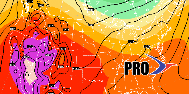
With a high temperature of 87°, Monday was the warmest day of the month in the Providence area. It will likely be the warmest day of the week. A strong cold front may trigger thunderstorms on Tuesday. The weather looks seasonable in the middle of the week. Looking ahead to Friday and the weekend, a couple of disturbances could bring showers. The first one arrives late Thursday night into Friday morning. It does not look like a washout, but showers are possible for the first half of Friday, and there may not be a ton of afternoon sunshine.
Dry weather is likely on Saturday before another storm threatens late in the weekend. At least some showers are likely on Sunday as the slow-moving large system moves out of the Mid-Atlantic. In a worst-case scenario, Sunday could be a cool washout. The overall weather pattern looks a bit cool for late June into early July. It also will be unsettled in the Eastern United States, and we’re expecting above normal precipitation in the next couple of weeks. This pattern will bring rain chances every few days, so it may take a little luck for the entire 4th of July weekend to stay dry.


