June is off to an unseasonably cool start. There has not yet been a warmer than normal day in the Providence area. Through the first eight days the temperature is running about 7° cooler than normal. After a rainy start, the weather has been mainly dry. Scattered showers are likely on Tuesday, but it does not look like a total washout.
We’ll get back to warm/dry weather from midweek into the weekend. A cold front will threaten with some mid-weekend showers and thunderstorms. It will likely get less humid on Sunday. Fair weather will continue into early next week before showers/storms threaten again late Monday or Tuesday.
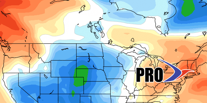
The overall pattern does not look too extreme through the next couple of weeks. The normal high temperature reaches 80° in two weeks, and it looks like that’s the ballpark that most days will be in around Father’s Day. There was unseasonable warmth in late-May, and unseasonably cold weather to start June. You can expect the pattern to be closer to normal into late-June.
Rainfall-wise, it does not look like there will be many chances of organized soaking rain in the next 10 days or so. Showers are possible Tuesday, mid-weekend, and early to middle of next week.


