It reached 90 in the Providence area for a fourth straight day on Tuesday. The rest of the workweek does not look as hot, but the humidity is not going anywhere.
WEDNESDAY
Patchy fog is possible early in the day. Low clouds will break up to yield partly sunny skies in the afternoon. There will be a sea breeze that keeps the temperature in the low to mid 80s at the coast. Inland locations will be in the mid to upper 80s. It will stay quite humid. Wednesday night will be muggy and mild. Lows will be near 70.

THURSDAY
It looks an awful lot like Wednesday – early clouds and fog, then partly sunny. Highs will be in the low to mid 80s. It will be humid. Wednesday night will be muggy and mild with patchy fog. Lows will be near 70 again.
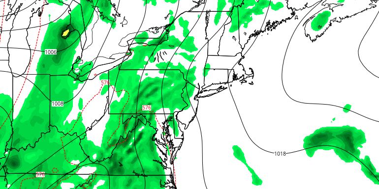
FRIDAY
A slow-moving front will trigger scattered showers and thunderstorms on Friday. The heaviest rain will stay west of Rhode Island. Skies will be partly to mostly cloudy. Highs will be in the low to mid 80s inland, and upper 70s to low 80s near the coast, where clouds could be stubborn. It does not look like a washout. It will be damp and mild Friday night. Lows will be in the upper 60s to low 70s.
WEEKEND
The disturbance that threatens the area with showers on Friday will linger near Southern New England this weekend. Scattered showers and thunderstorms are possible Saturday and Sunday. Neither day looks like a washout, but both days will likely feature pop-up showers/storms in RI and SE MA. It will stay muggy. Highs will be in the upper 70s to low 80s. Lows will be near 70.


