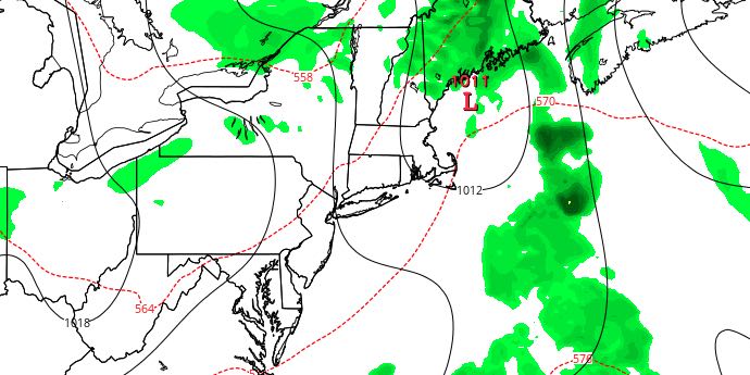
Less Humid, Still Warm on Wednesday

A cold front moving through Southern New England triggered scattered thunderstorms in CT and MA Tuesday evening, and may bring showers and storms to RI and SE MA late at night. The front will move offshore by early Wednesday morning with drier weather moving in as it departs.
WEDNESDAY
Early clouds will give way to mostly sunny skies. A west wind will finally lower the humidity in Southeastern New England. It will be a warm day with highs in the mid 80s. The breeze will be 10-15 mph in the afternoon. Dew points will fall into the mid 50s to low 60s during the day. Wednesday night looks mainly clear with lows near 60.

THURSDAY AND FRIDAY
It will be partly cloudy to mainly clear through the end of the workweek. Highs will be in the upper 70s to low 80s both Thursday and Friday. It will be comfortable at night with lows in the mid 50s to low 60s.
WEEKEND WARM-UP
The last weekend of August will be a warm one. After a clear and comfortable start, Saturday will be mostly sunny and warm. Highs will be in the mid 80s. It will start to get muggy again Saturday night into Sunday. Lows will be in the mid to upper 60s early Sunday morning. Sunday afternoon looks partly cloudy with highs in the mid to upper 80s.
EARLY NEXT WEEK
The very warm weather will continue into early September. Highs will flirt with 90 from Monday into the middle of next week. It looks mainly dry, with partly to mostly sunny skies during the day. Lows will be in the mid to upper 60s.


