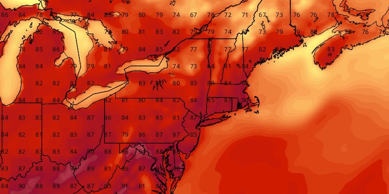
Very Warm Start to September

The weekend ended with highs near 90 inland, and the first week of September will feature more of the same in Southeastern New England.
MONDAY
It will be a mainly clear, mild, and muggy start to the day. Lows will be in the mid to upper 60s. The afternoon looks partly to mostly sunny, breezy, and very warm. Highs will be 85-90 inland, and in the low 80s near the coast. There will be a 10-25 mph southwest breeze.

TUESDAY
Look for a bit of patchy fog at the start of the day. That will burn off to mostly sunny skies. Highs will be in the mid to upper 80s, with noticeable humidity. Tuesday night will be muggy and mild, with lows in the mid to upper 60s. It will stay dry throughout.
WEDNESDAY
It looks like another very warm to hot day. Highs inland may reach the low 90s. It will stay in the 80s at the coast with an onshore breeze. Once again, it will be rather humid. Lows will be near 70 with muggy conditions Wednesday night.
THURSDAY
The temperature will be near 90 again on Thursday. The coast will be several degrees cooler with an onshore breeze. An approaching cold front may trigger isolated showers and thunderstorms Thursday PM as it drifts south. It will lead to a briefly cooler and less humid stretch into the early part of the weekend.
FRIDAY
It looks like a great day. Skies will become mostly sunny, and highs will be in the upper 70s to low 80s with a northeast breeze and lower humidity. Friday night will be clear and comfy, with lows near 60.
NEXT WEEKEND
Unseasonably warm weather works its way back into Southeastern New England next weekend. Highs will be well into the 80s Saturday and Sunday. Clouds will increase late Sunday, and a few evening showers or storms cannot be ruled out. The early, early outlook for Labor Day is for warm and mainly dry, but humid weather.


