A dry weather pattern will continue in Southeastern New England. A storm will move out to sea east of New England early in the week, and there is little chance for rain. Most of the week will feature clear skies and seasonable conditions.
MONDAY
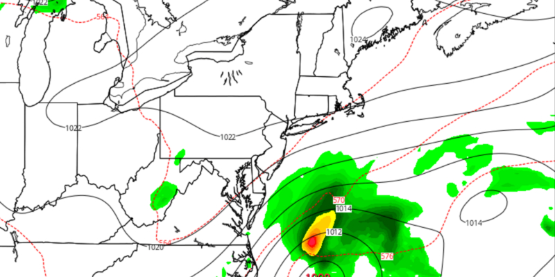
Look for a clear and cool start to the day. Lows will be near 50. It will be mostly sunny and breezy in the afternoon. Highs will be in the low 70s. Monday night will be partly to mostly cloudy with lows in the low 50s. The northeast breeze will continue as a storm moves off the Mid-Atlantic coast.

TUESDAY
This looks like the best chance of rain in the upcoming week, but it is minimal. We are fairly certain that a storm in the Atlantic Ocean will move far enough offshore that all of Southeastern New England stays dry. Look for mostly cloudy skies with highs near 70 and a gusty northeast breeze. Skies will become partly cloudy Tuesday night. Lows will be near 50.
WEDNESDAY-THURSDAY
You can expect a warm-up Wednesday and Thursday. Highs will be in the mid 70s on Wednesday, and mid to upper 70s on Thursday. Both days look mostly sunny. Lows will be in the 50s.
FRIDAY INTO THE WEEKEND
A cold front will pass by on Friday, and it will bring cooler weather back to Rhode Island and Southeastern Massachusetts. Highs will be in the mid 60s to low 70s on Friday. The front will likely pass without many clouds. High pressure will move overhead next weekend. Look for mostly sunny skies with highs in the low 70s. The nights will be clear and cool.


