September is cooking so far in Southeastern New England. The temperature is running more than 4° warmer than normal in the Providence area. It hit 90° at TF Green on Monday afternoon. Another 90° day is likely on Tuesday. The humidity is sticking around, too. Lows will be about 10° warmer than normal through the middle of the week. Wednesday afternoon may not be as hot with more of a southerly component to the wind, but it will still be much warmer than normal for September.
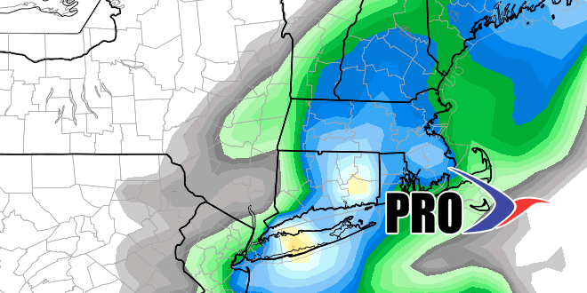
Cooler weather finally arrives late in the workweek. With it will come showers and thunderstorms Thursday and/or Friday. The best chance of rain is from Thursday afternoon through Friday morning. There is a good possibility of a decent soaking – at least for some of Southeastern New England as low pressure that is near Florida today is drawn north by the approaching cold front.
The early outlook for the weekend is for better weather on Saturday than Sunday. Both days look seasonable with highs in the 70s. Sunday does not look like a washout, but we’ll keep an eye on a similar setup to Friday, with a storm possibly developing along a front. The early to middle part of next week looks dry and seasonable. Showers are possible late next week. Overall, the relatively warm September will continue, just not to the degree that we’re seeing now. Check out the video for more.


