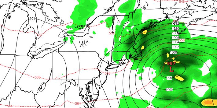
Much-needed rain continues Tuesday night into Wednesday morning. It will be windy near the coast, with gusts over 30 mph likely. There will be a break in the showers Wednesday afternoon through Thursday morning before another round arrives.
TUESDAY NIGHT
Off and on rain is likely. It will become windy, especially near the coast. 10-20 mph northeast winds may gust to 30-40 mph late at night into early Wednesday morning. The temperature will be in the 40s.

WEDNESDAY
Wind-driven showers continue Wednesday morning before drier weather arrives in the afternoon. The rain does not look terribly heavy, and storm totals will range from 0.5-1.0″ in RI and SE MA. It will be a cool day, with highs in the upper 40s to low 50s.
THURSDAY
Clouds will thicken again on Thursday as a cold front approaches from the west. A southwest breeze will get the temperature into the mid to upper 50s by afternoon. Showers are likely in the afternoon and evening.
FRIDAY
It looks like a decent day as one system moves away and cooler air lags behind. Highs will be in the upper 50s with partly sunny skies. It will turn cooler with a northwest wind Friday night. Lows will be in the upper 30s to low 40s Saturday morning.
WEEKEND
Saturday and Sunday look dry, but chilly. Highs will be in the mid to upper 40s with partly cloudy skies both days. A northwest breeze will make it feel even colder, especially on Saturday. Lows will be in the 20s to low 30s Sunday morning. Milder weather returns early next week.


