December 2015 blew away the record warm monthly temperature in the Northeast. It was nearly 12° warmer than normal in the Providence area. It was also a wetter than normal month, but there was less than 1″ of snow.
The weather will be benign to start 2016. The weekend looks seasonable before a cold shot early next week. A brief intrusion of Arctic air could keep high temperatures in the 20s Monday and Tuesday, with lows in the teens. A wind chill will have it feeling even colder. The Arctic chill relents quickly by mid to late workweek, and it will likely stay dry.
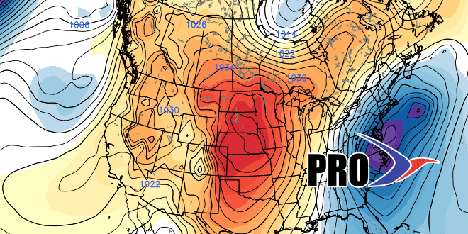
The dry pattern will not continue through mid-January. Early signs are that there could be a storm next weekend or early the following week, and the overall theme of mid to late January is looking cold (maybe not colder than normal, but cold enough) and somewhat stormy in the Eastern United States. While I don’t think we’re in for a stretch anything like the one we had from late-January to early March last winter, there could be a few weeks where you know it’s winter in New England. It would be in stark contrast to the slew of 50-60° days we saw in December.


