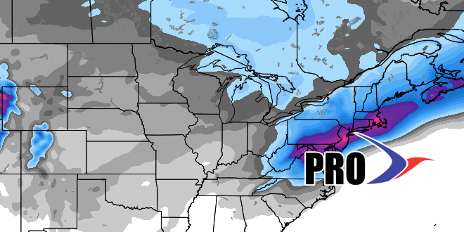
We are in the midst of another cold snap, but the forecast focus has already shifted away from bitter wind chills to a significant storm threat this weekend. Computer models agree that a storm will form along the Mid-Atlantic coast early this weekend. The exact track of the storm is not known, but the current consensus computer model track brings a significant Nor’easter to the Mid-Atlantic and Southern New England. I will have updates throughout the week on this potentially high-impact event.
Some people are probably wondering if this storm is the start of another very snowy/cold stretch like we saw last winter when a big storm hit in late-January. This time around, it looks like the weather will stay active into February, but the prevailing storm track should be closer to the coast or inland, and that will lead to more mixed precipitation events, instead of the all-snow storms we saw last year.
Temperature-wise, after a cold start to the week, it will not be far from normal by midweek, and there does not look like there will be many extreme temperature swings in the next couple of weeks.
After the weekend storm threat, an Alberta Clipper is possible in the middle of next week, with another storm possible around Feb 1. See the video for more.


