A warm and wet December followed by a quiet start to January. Sound familiar? It should. Last winter featured mild and wet conditions in December, and not much snow in January until the last week of the month. I’m not saying the same flip to a historic snowy and cold stretch is on the way for this winter, but it will certainly be colder and snowier than it has been.
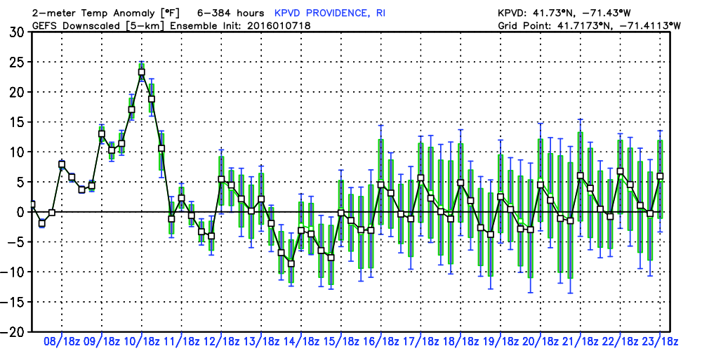
In the near term, a storm on Sunday will bring rain, strong coastal winds, and record high temperatures. It will be followed by a chilly, but mainly dry week. The best chance of snow during next workweek is Wed-Thu as a storm most likely develops just a bit too far east for significant accumulations. Instead, we’ll probably just get snow showers.
We are targeting Martin Luther King weekend, particularly Sunday-Monday as the time frame for a more significant storm in the Northeast. The models have hinted at it for a few days, and the pattern is ripe for it. Unfortunately for snow lovers, the latest European monthly computer model run is not overly impressive late in January and in early February. Somewhat surprisingly, it does not have many storms during that stretch. It may just be one run, and I can see where it has some “close, but no cigar” scenarios with the two branches of the jet stream linking up. One thing that we are not seeing a lot of is brutally cold weather in mid to late January. It’ll feel like winter next week, but it’s certainly nothing extreme.