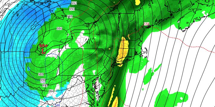
Back-to-back storms will bring mainly rain to Southeastern New England in the midweek. The first storm arriving Tuesday evening may feature a period of snow before rain showers arrive around midnight. A coating to an inch of snow is possible away from the coast, and mainly on the grass. The temperature will be above freezing for most of RI and SE MA through the night. The threat of snow is between 5-11 pm, with rain likely afterward. It may be all rain near the coast.
Wednesday looks like a damp and unsettled day with a few showers, but not a lot of steady rain. It will be breezy, with temperatures climbing into the mid 40s. The best chance of steady rain is Wednesday night into early Thursday as a strong cold front passes. Look for heavy downpours between 2-7 am on Thursday, with wind gusts over 40 mph possible near the coast. The temperature will soar into the mid 50s Wednesday night into Thursday.

Steady rain will be out of the picture between 7-9 am on Thursday, and the rest of the day looks mostly cloudy with a passing shower possible. The temperature will be in the low to mid 50s. Quiet and seasonable weather is likely on Friday. The weekend looks dry and milder.


