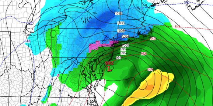
Spring begins on Sunday, but it may start with some wintry weather Sunday afternoon into Monday morning. A storm system moving northeast off the East Coast will likely bring snow and/or rain to Southeastern New England. The track of the storm is very important. If it comes close to the coast, it will be mainly rain. A slightly offshore track would lead to heavy, wet snow.
FRIDAY
Partly to mostly cloudy. Pop-up showers and thundershowers possible from late-morning through the afternoon. Can’t rule out some small hail in any of the showers/storms. Highs in the low 50s, turning cooler in any showers.
SATURDAY
Mainly clear, cool. Lows in the 20s. Highs in the low 40s.
SUNDAY
Clouds increase, snow develops by late in the day. Highs in the mid 30s. Wind increases to 10-25 mph out of the northeast. Snow and/or rain likely at night. Precipitation may be heavy at times. If all snow, several inches of accumulation is likely. Best chance of all snow is inland. Windy, especially near the coast. Temperature holds in the low to mid 30s at night.

MONDAY
Snow and/or rain ends in the morning. Blustery and cool. Highs in the upper 30s.
MIDWEEK
It will stay cool through the middle of the week. Tuesday looks dry. Rain showers are possible on Wednesday. Highs will be in the 30s to mid 40s.


