A relatively cool weekend will be followed by warmer weather in the midweek. A cold front will swing through New England on Thursday or Friday bringing cooler weather late in the week.
SUNDAY
Some early clouds, then becoming partly to mostly sunny. A light breeze. Seasonable, with highs in the low 40s. Lows will be in the upper 20s to low 30s under partly cloudy skies Sunday night.
MONDAY
Much warmer weather will move into the Ohio Valley and Mid-Atlantic on Monday, and the temperature should be warmer than normal in RI and SE MA. Look for partly sunny skies with highs in the mid 40s near 50. It will not be too cold Monday night, with lows near freezing.
TUESDAY
It will feel like spring on Tuesday. There should be a decent dose of sunshine, and highs will be in the low 50s at the coast, and mid to upper 50s inland.
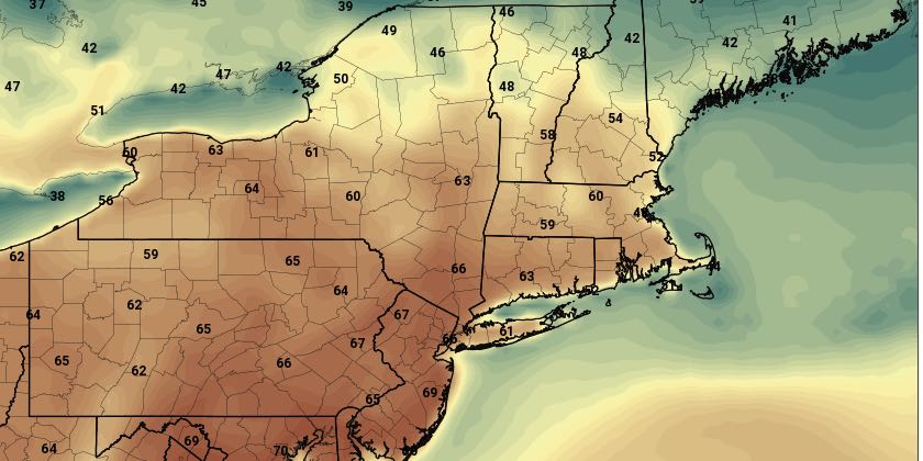
WEDNESDAY
Wednesday looks like the warmest day of this stretch, with highs in the 60s inland, and 50s near the coast. It will stay dry through the day on Wednesday. Clouds may increase late in the day.
THURSDAY
A front moving south will bring cooler weather to Southern New England sometime on Thursday. The timing of the front is very important in determining whether we’ll squeak out one more very warm (for early March) day. Right now, we expect the temperature to reach 60 again before clouds and showers threaten, but it’s a close call.
FRIDAY
Showers are possible in the morning as a disturbance rides along the front that will bring cooler weather. Highs will be near 50 – still not bad for early March.


