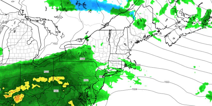
Relatively cool weather will persist through most of the workweek in Southeastern New England. It will be a close call with showers in the midweek, but it looks like most of the unsettled weather will stay south of our area.
MONDAY
Partly cloudy, breezy to windy. Highs only near 60. Lows will be in the mid 40s at night under partly cloudy skies.
TUESDAY
Clouds increase as a storm develops over the Mid-Atlantic. Odds are the steady rain stays away, but a few showers are possible in the afternoon. Highs will be in the mid 60s.
WEDNESDAY
Mostly cloudy, on the cool side again. Highs in the low to mid 60s with a northeast breeze. Lows will be in the 40s Wednesday night.
THURSDAY
Clouds are likely, with a few afternoon showers possible. It does not look like a washout. Highs will be in the mid 60s – still cool for mid-May.
FRIDAY
Increasing sunshine, and a bit warmer, with highs in the upper 60s.
WEEKEND
Saturday should be a nice day. Look for mostly sunny skies and highs in the low 70s. The early outlook for Sunday is decent, but we need to watch a storm that will likely develop over the Southeastern United States. If that stays away, look for highs in the 70s with some sun.


