UPDATE
The storm will likely track a little farther east the earlier projected, and that means less rain, but still some showers Saturday night into Sunday morning. There is also a better chance of a brighter sky on Sunday afternoon, and highs may reach the mid 60s.
FROM EARLIER
A storm system will bring rain to Southeastern New England late Saturday into Sunday. The heaviest rain is likely Saturday night, but clouds will hang around through Sunday. It will stay damp and dreary with showers, drizzle, mist, and temperatures in the 50s. A northeast breeze will make it feel even cooler. After an unsettled start to next week, warmer weather is likely in the mid to late workweek.
SATURDAY
Clouds increase. Rain likely holds off until late in the day or during the evening. Plenty of time to mow the lawn! Highs in the mid to upper 60s around noon, then turning cooler as clouds thicken and a breeze picks up in the afternoon.
SATURDAY NIGHT
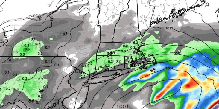
Rain likely, may be heavy at times. 0.75-1.5″ rain is possible in RI and SE MA. Northeast winds 15-30 mph, strongest near the coast. Some downed branches are possible if winds gust over 35 mph. Temperatures in the low to mid 50s.
SUNDAY
Cloudy and damp with a few showers, plus patchy drizzle and mist. Breezy and very cool for late-May, with highs in the low to mid 50s. It will stay damp with some fog possible Sunday night.
Monday and Tuesday both look cloudy to mostly cloudy with scattered showers possible. Neither day will be a washout, and highs will only be in the low to mid 60s. Much warmer weather arrives on Wednesday when the sun breaks through. Highs will quickly approach 80 inland on Wednesday and Thursday.


