A Glance at the Week Ahead

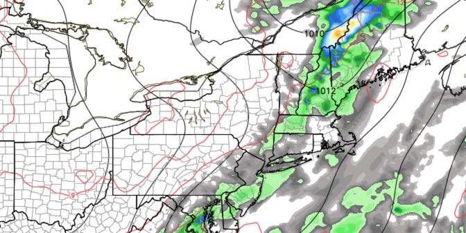
June has been a dry month in Southeastern New England. Most of the area has received about an inch of rain, instead of the average of three inches that usually falls in the first four weeks of the month. Humidity has also been low most of the time this month, but that will change in the last few days as a more typical summer feel arrives in New England.
MONDAY
Morning sunshine, some afternoon clouds. Scattered showers are possible Monday night, but it will most likely stay dry. Highs near 80. Lows in the mid 60s.
TUESDAY
Partly cloudy, scattered showers and t-storms are possible, especially at night. Humid with highs in the upper 70s to low 80s. Lows in the mid 60s again.
WEDNESDAY
Scattered showers and t-storms. The best chance of rain is in the morning. Partly to mostly cloudy. Highs near 80.
THURSDAY
Partly cloudy. A lower chance of any showers/storms. Highs in the low 80s.
FRIDAY
Sun and clouds. Pop-up showers and t-storms are possible in the afternoon. Highs in the low 80s.
4th of JULY WEEKEND
Saturday will be partly to mostly sunny, warm and humid. Highs in the mid 80s. There is a chance of showers/t-storms on Sunday as a front passes through. The early estimate is for the best chance of rain in the morning. Highs will be near 80 on Sunday. The outlook for the 4th is for dry and pleasant weather, with highs in the low to mid 80s.


