A gusty and cool northwest breeze continues Sunday night into Monday. Unusually dry air for mid-June will settle into New England early in the week. There will likely be a storm that forms near the Southeast or Mid-Atlantic coast late in the workweek. There is some uncertainty about whether that storm will drift north to bring rain to Southeastern New England or if the dry stretch will last through the Father’s Day weekend.
MONDAY
Mostly sunny, breezy to windy. Low humidity. Near 50 early in the day. Highs 70-75. Partly cloudy, breezy, cool Monday night. Lows in the 50s.
TUESDAY
Sun and clouds. Highs in the mid 70s. Cool again Tuesday night. Lows in the 50s.
WEDNESDAY
Mostly sunny, a bit warmer, but not very warm for mid-June. Highs in the mid to upper 70s.

THURSDAY
Partly cloudy. Highs in the 70s. A storm moving through the Great Lakes to the Mid-Atlantic will have a lot to say about the cloud cover and temperature in RI and SE MA.
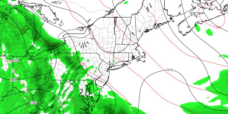
LATE-WEEK
Watching the storm that moves to the Mid-Atlantic and/or Southeastern United States. If it stays far enough south, then fair weather continues, with a warm-up into the 80s by late in the weekend. However, it may drift far enough north to bring showers on Friday, and possibly for part of the weekend. Right now, the odds favor mainly dry and nice weather continuing, but it’s a forecast to pay attention to.


