July finished 2.5° warmer than normal with 120% of the normal amount of precipitation in the Providence area. There were two 3-day heat waves, and a total of nine days over 90°. The highest temperature for the month 94° on July 6. Other parts of Southeastern New England were also warmer than normal, and the rain totals varied due to the showery nature of summer precipitation.
We are heading into August with scattered showers Monday into Tuesday morning. Most of the the time it should be dry, but the air will contain enough water that if there are showers, there may be some heavy downpours. When it’s not raining, you can expect partly to mostly cloudy skies and highs in the upper 70s to low 80s on Monday. It will be mild and muggy Monday night, with lows in the upper 60s. Tuesday should be brighter in the afternoon after the chance of a few morning showers. Highs will be near 80.
The weather looks relatively quiet for most of the rest of the week. There will be a gradual warming trend into the weekend before a cold front sweeps through with showers/storms possible on Saturday. Highs will be in the low 80s on Wednesday, and may creep back to near 90 inland on Friday. It will be comfortably dry in the midweek, but increasing humidity is ahead for late in the week and the start of next weekend.
Looking ahead to the following week…it looks dry through most of the week with a better chance of some showers by late in the workweek or the weekend of August 13-14. The pattern does not favor extreme heat in the Northeast.
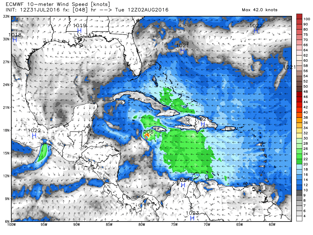
The tropics may be heating up a bit. A tropical wave moving into the Southern Caribbean could become tropical storm Earl by the middle of the week. The National Hurricane Center gives it a 50-70% chance of developing into a tropical storm by the end of the workweek. It’s projected track is south of the islands. It may impact the Yucatán Peninsula by Wed-Thu.