After a relatively cool start, August turned much hotter in the second week of the month. Monday will be hot, but not extremely humid. It will get very muggy and unsettled in the midweek. The best chance of rain is on Tuesday as a warm front brings the high humidity back to Southeastern New England.
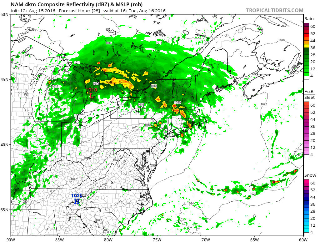
Highs will approach 90° on Monday, but the dew point will be in the low to mid 60s, making it more comfortable than the weekend. Showers and thunderstorms are likely on Tuesday. The dew point will climb into the low to mid 70s. There is a 5% chance of severe weather in RI and SE MA. At this time of the year, a warm front can bring severe thunderstorms with a low risk of weak tornadoes or even a waterspout. The best chance of t-storms is during the day on Tuesday.
It will turn less humid again on Wednesday. A scattered t-storm is possible as a cold front passes. Highs will be in the 80s with partly sunny skies. The weather looks pretty quiet late in the week. Highs will be in the 80s with lows in the 60s with fair weather Thursday into, and probably through the weekend.
A slow-moving frontal system will reach the Appalachians by late in the weekend. It’s unclear if that area of rain will move all the way through RI and SE MA or if it will weaken before reaching the Atlantic Seaboard. There is an increasing chance of rain early next week.
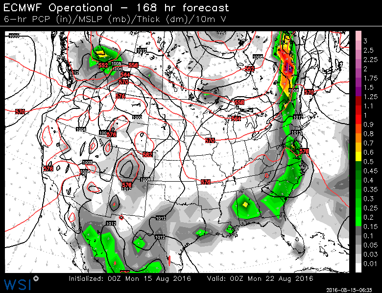
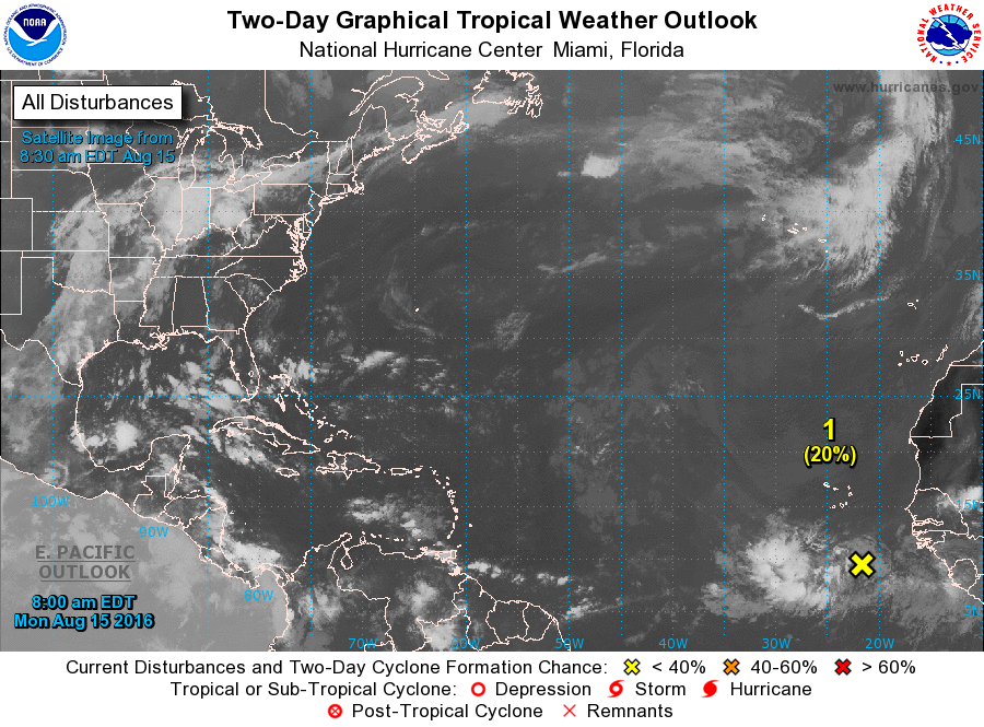
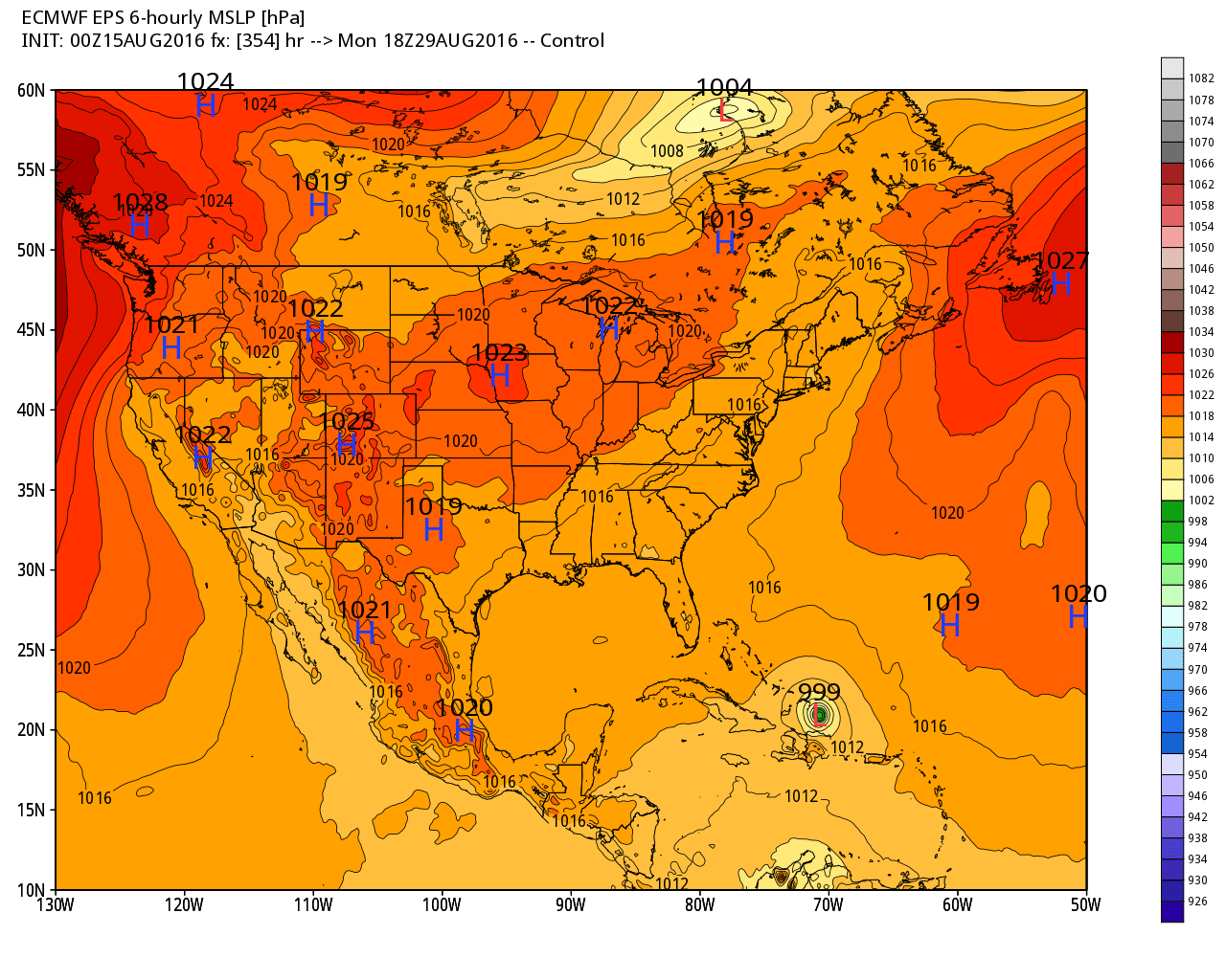
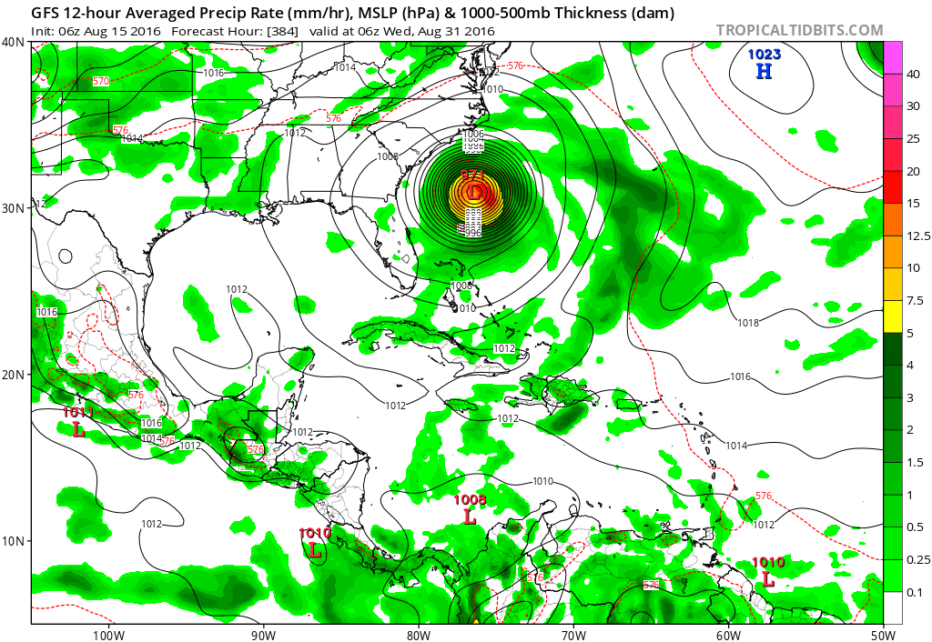
This is the time of the year when the tropics typically become more active. There is a tropical wave worth watching off the African coast. As you can see, longer range computer models are predicting some action in the Caribbean or Atlantic in the next couple of weeks. It’s important to not take these long-range forecasts literally, but, rather to see the potential for storms to form in the next two weeks.