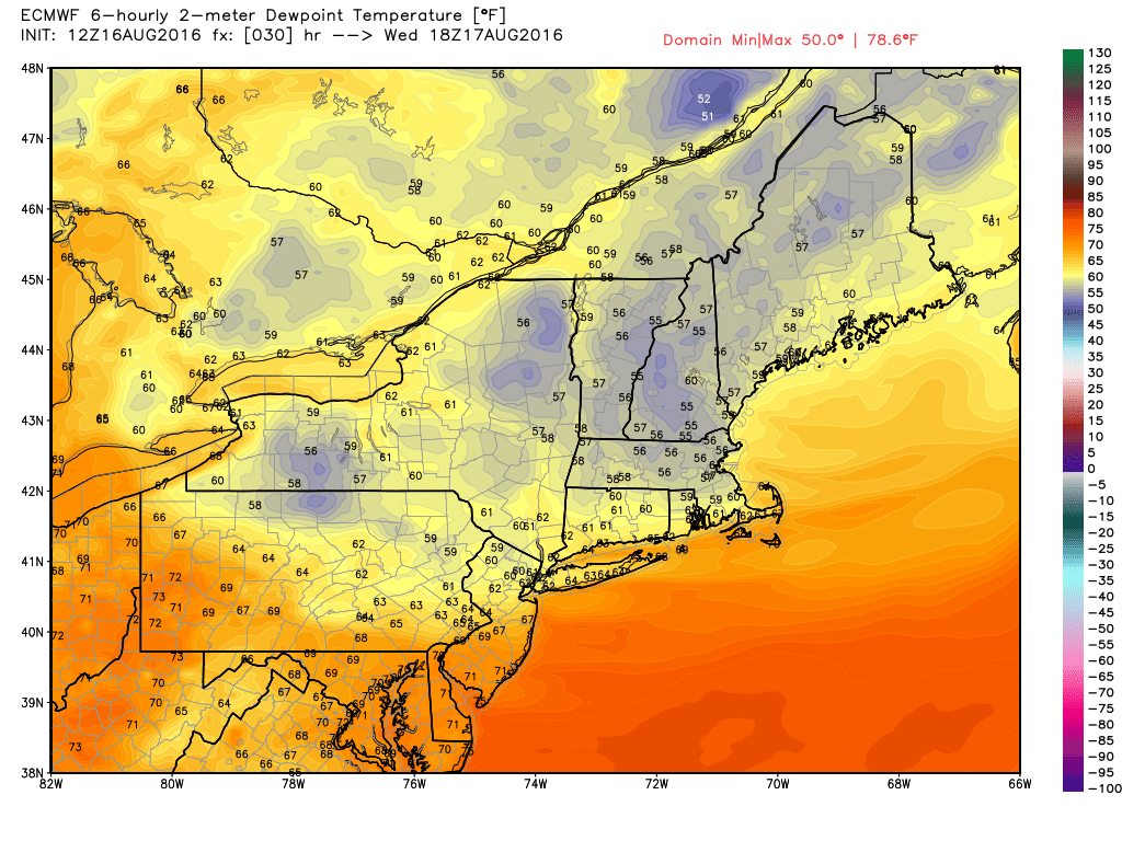
Oppressive humidity continues Tuesday night as the temperature dips only into the mid to upper 70s by dawn on Wednesday. We’ll get back to a blend of sun and clouds on Wednesday, and a northwest to west breeze will bring in drier air. Highs will be in the 80s with dew points falling through the 60s. It won’t be bone dry, but it will be more comfy than Tuesday was!
The weather looks fairly quiet from Wednesday through the weekend. It will be warm Thursday and Friday, with highs in the mid to upper 80s inland, and low to mid 80s at the coast. Both days look partly to mostly sunny, with Friday the sunnier of the two days. Lows will be in the 60s to near 70. It will not be too humid, but not too comfy, either.
Saturday and Sunday will both feature sunshine blended with clouds, and a slight chance of pop-up showers and t-storms from midday into the afternoon. The wind will swing around to the southeast then south, bringing in muggier weather by late Saturday through Sunday. It will be seasonable with highs in the 80s. We expect showers and t-storms on Monday as a front passes. The rain may hold off until late in the day. The middle of next week looks great. Look for sunshine and lower humidity, with highs in the upper 70s to low 80s on Tuesday before it gradually gets warmer.


