Southeastern New England will enjoy gorgeous weather for the rest of the workweek. There will be plenty of sunshine and highs in the 70s at the coast to low/mid 80s inland Wednesday through Friday. It will not be oppressively humid, and overnight lows will range from the upper 50s to mid 60s under clear skies. Patchy fog is possible late at night, but it will burn off to mostly sunny skies Thursday and Friday.
An approaching cold front brings humid weather on Saturday. There will also be increasing clouds and thunderstorms possible in the afternoon and evening. The high temperature depends on how long skies will stay mostly sunny. It looks like it will be in the low to mid 80s, but could be hotter if clouds are delayed. The shower/storm threat ends by midnight, and skies will clear by dawn on Sunday.
Another spectacular stretch of weather is ahead from Sunday through most of next week. The week will begin with low humidity, but it should get warmer and muggier by late in the week into the weekend of August 13-14. Eventually, a slow-moving frontal system will move to the Eastern Seaboard increasing the possibility of showers/storms. It’s unclear if that will be before, during, or after that weekend. Earlier this week, it looked like a front would bring a rain threat by next Thursday, but that system will likely stay to our west, so it’s possible the dry stretch will last through next weekend. Expect some 90° heat inland late next week.
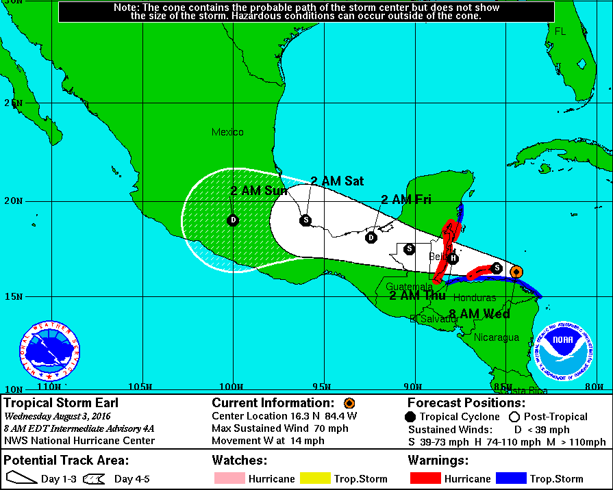
Tropical Storm Earl is heading for Belize with winds of 70 mph. It may become a hurricane before making landfall Wednesday night. It’s no threat to the United States.