A soggy Monday gives way to slightly unsettled weather through the middle of the week. Earlier, it looked like the rain threat would last through Tuesday before it dries out Wednesday. Now, however, the rain threat is limited to pop-up showers on Tuesday, but there is still a chance of more showers flaring up on both Wednesday and Thursday. It will be dry most of the time, but scattered showers and even a t-storm cannot be ruled out through Thursday afternoon. It will get muggy again, with lows in the mid to upper 60s through the midweek. Some sunny breaks may get the temperature to near 80 in the afternoon on Tuesday. 70s are likely Wednesday and Thursday.
Fair weather is ahead for Friday through the weekend. Unless there is a big change in the forecast, I would not expect any impact from Florence in New England through the weekend. It will be seasonably warm with highs in the 70s to low 80s, and lows in the low 60s this weekend. What happens with Florence’s remnants is still questionable, but the odds of a major hurricane strike for South Carolina or North Carolina are increasing. The storm strengthened on Monday, and may be come a category 4 or 5 storm in the next couple of days. Landfall is expected Thursday. The damage may be devastating from the wind and storm surge at the Carolina coast. Many computer models are projecting that Florence will move inland and stall. The storm’s winds will weaken quickly, but the torrential rain could bring a major environmental catastrophe to part of the mid-Atlantic and Southeastern US – particularly the Carolinas and Virginia. It’s possible some areas could get 2-3 feet of rain. Hurricane Floyd did tremendous damage with lower rain totals in 1999.
Ultimately, the remnants of the storm may get caught in the jet stream and bring rain to Southern New England. Odds favor nothing too heavy if it happens next week. If what’s left of the storm heads our way sooner, it may have more tropical moisture left and the potential for heavier rain. I am not favoring that scenario at this point.

20+” of rain possible in the Carolinas and/or Virginia
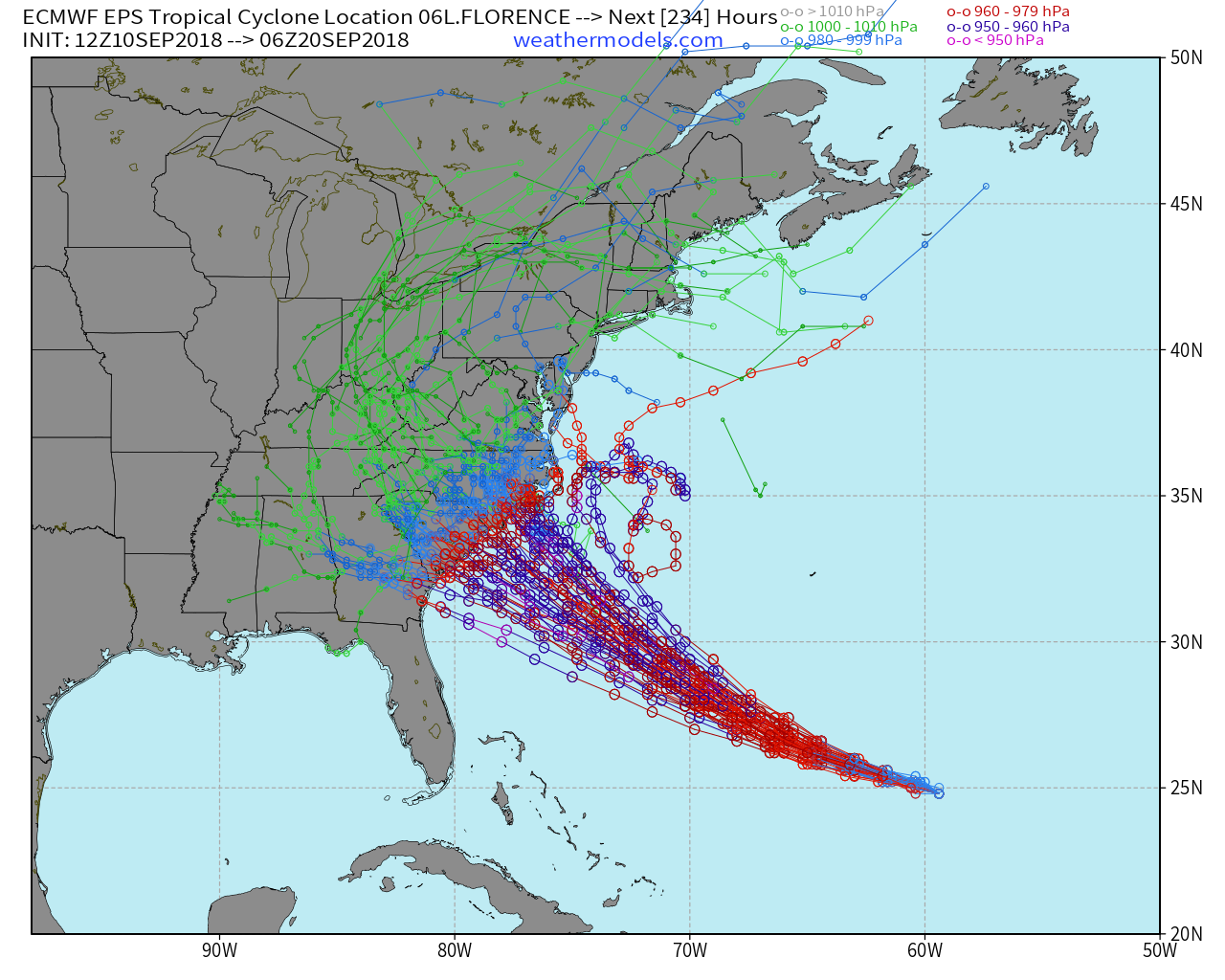
EPS model spread shows most tracks confined to the Carolinas and then slowly moving inland bringing a major flooding rain threat


