A dry weather pattern continues in Southeastern New England. There was a decent soaking on September 1, but since then the pattern has not produced much steady rain. In addition, the temperature is running well above normal as we near the midway point of the month. In short, this September is following the same theme that we saw during the summer months.
While there is no 90° heat in the forecast for this week, it will still likely average a little warmer than the 75°/55° weather that is normal for this time of the year. Highs will be in the mid to upper 70s Monday and Tuesday with plenty of sunshine. Clouds will increase late Wednesday, but the temperature should reach the low to mid 80s inland with a southwest breeze. Lows will be in the 50s early in the week, and in the 60s on Wednesday.
A passing shower is possible Wednesday night, but steady rain is highly unlikely in Southeastern New England. There is a better chance of rain in Northern New England. The rain threat comes ahead of a cold front that will sweep through the area late Wednesday night. The temperature will fall into the mid 50s by dawn on Thursday with clearing skies.
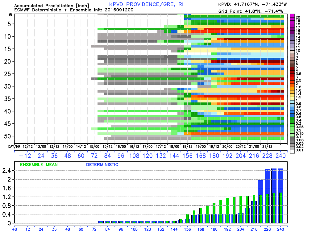
Thursday and Friday look near-normal or slightly cooler than normal, with highs in the low to mid 70s, and lows in the upper 40s to mid 50s. Both Days should be mostly sunny. Nice weather continues into the weekend, with highs in the mid 70s on Saturday. The early outlook for next Sunday is mostly cloudy skies with showers possible. It’s too early to say if it will be a washout, but the computer models are in decent agreement that there will be at least some rain between Saturday night and Sunday night.
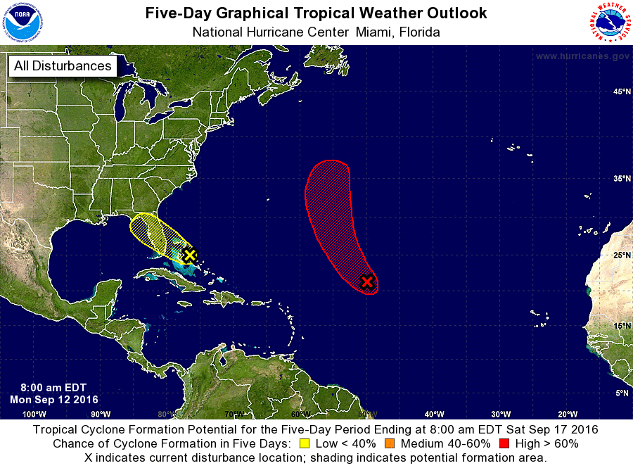
The tropics are relatively quiet. We will likely see Tropical Storm Ian form in the Atlantic soon, but it is no threat to land. Another disturbance in the Bahamas has a low chance of development.