Right Weather Pro

September 28th Update

UPDATE
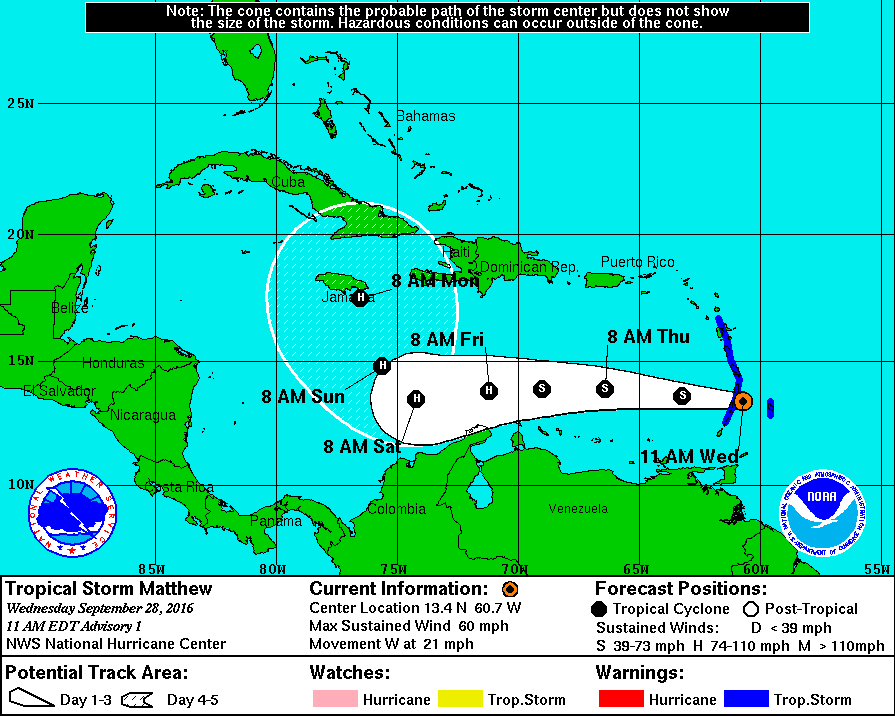
The National Hurricane Center named Tropical Storm Matthew a few minutes after I posted this update.

145747w5_nl_sm

FROM EARLIER

A slightly cool and unsettled weather pattern is ahead for late this week into early next week. Steady rain will likely hold off until late in the workweek, and there are showers in the forecast for this weekend. The slow-moving storm system may throw more showers into Southeastern New England early next week before finally moving away from the Northeastern United States.

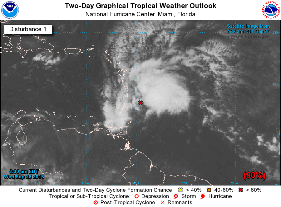
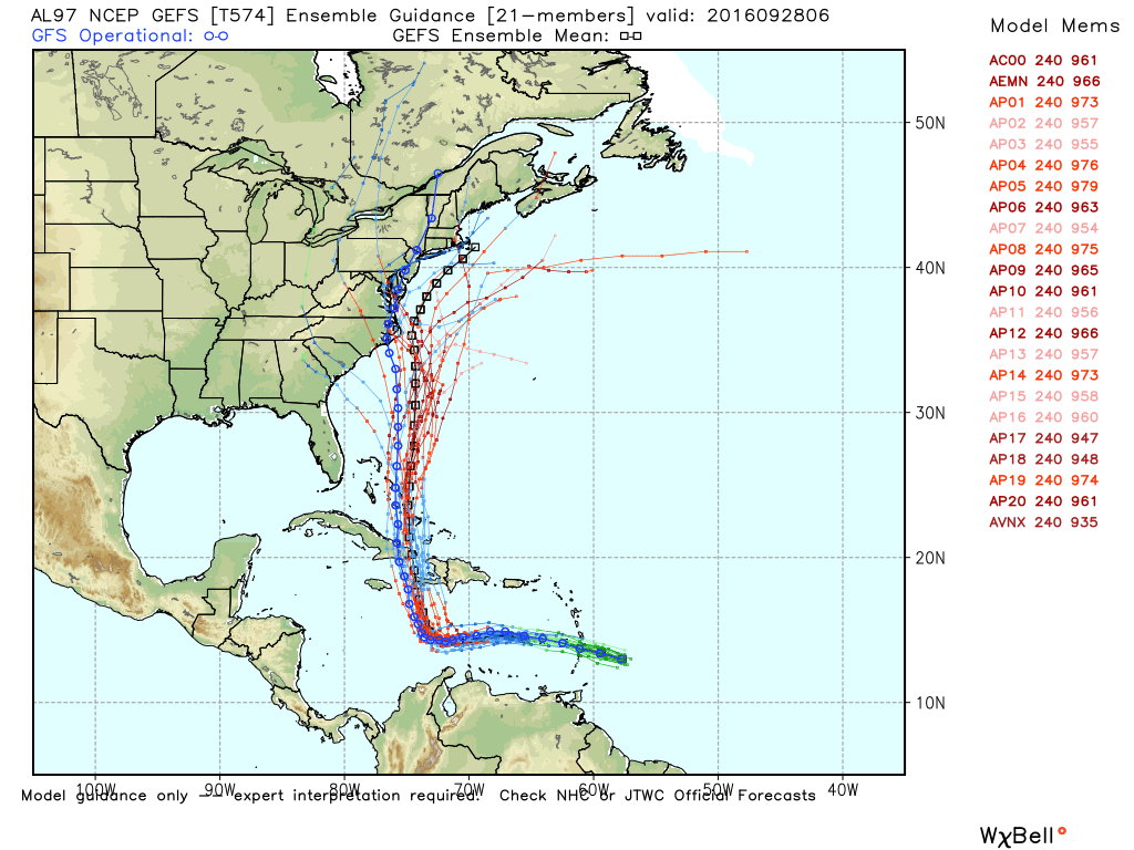
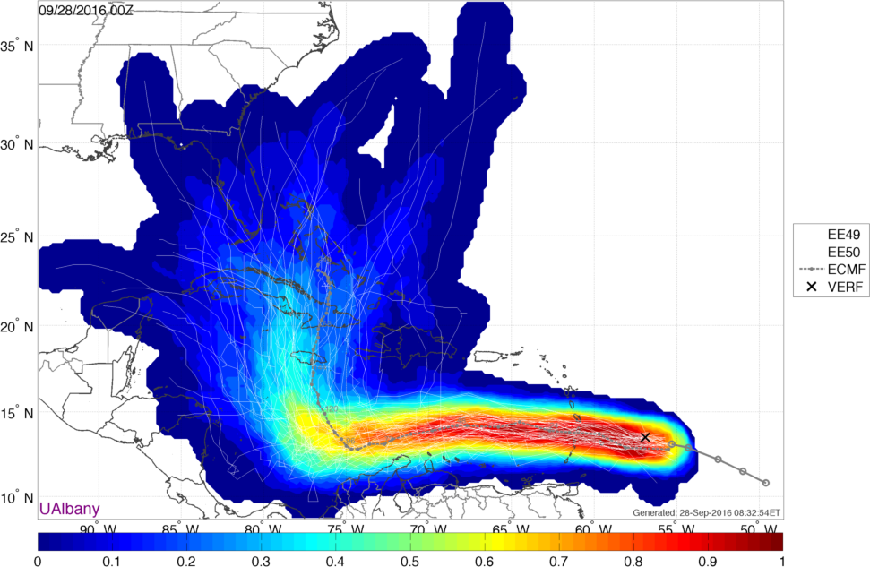
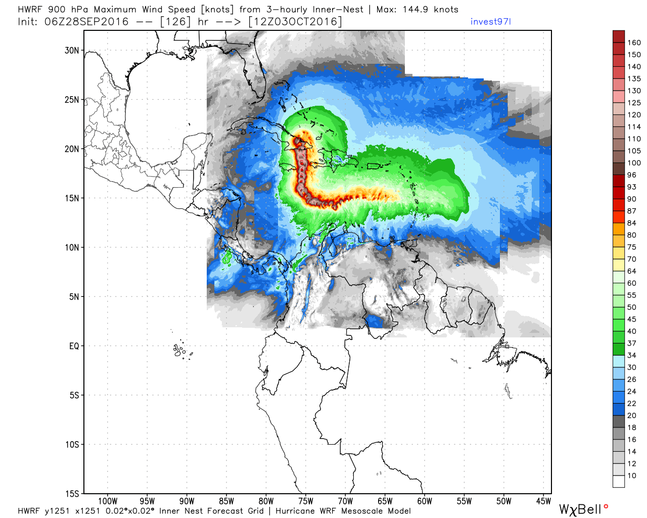
There is also a lot of buzz surrounding the system that will likely become Matthew in the Southern Caribbean. It looks healthy Wednesday morning, and strengthening is likely in the next few days. The short-term forecast is fairly certain, but where it goes after it turns north is questionable.

Wednesday and Thursday will be cloudy and breezy in RI and SE MA. There may be patchy mist and drizzle. The temperature will hover in the mid 50s at night, and low to mid 60s during the day. Steady rain is not expected through Thursday, but it will be damp at times.

Showers are likely on Friday afternoon

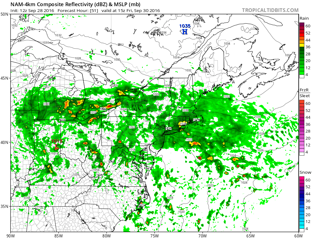
There is a better chance of showers Friday into the weekend as a slow-moving storm moves east. Expect some rain on Friday, with highs in the low 60s and an easterly breeze. The best chance of steady rain is in the afternoon and at night. More showers are likely on Saturday. Highs will be in the low 60s again.

An unsettled pattern continues into early next week. Showers may persist on Monday. Highs will be in the 60s. Gradual improvement is ahead for the middle of next week. Look for seasonable conditions by the middle to end of the workweek. Highs in the 60s, lows in the 40s to low 50s.

Invest 97L looks healthy, and will likely become a tropical depression or tropical storm later Wednesday
Most EPS ensembles have a hurricane somewhere between the Gulf of Mexico and the Bahamas at some point next week. Anyone with interests in south Florida should be paying very close attention to this storm.
The GEFS ensemble wants to bring the storm north through the Bahamas to a threatening position off the Southeastern United States coast. I am not sold on this scenario.
This gives you an idea of the uncertainty of the track for Matthew. The brighter colors indicate a high-confidence forecast. The darker blues are lower confidence.
Strengthening is likely for Matthew, and it may be a hurricane by the end of the week.
The GFDL model keeps Matthew on a more gradual WNW path
The HWRF computer model projects a sharp turn to the north for Matthew

Fred Campagna

President and Chief Meteorologist - Right Weather LLC AMS Certified Consulting Meteorologist #756 AMS Certified Broadcast Meteorologist #126

Related Articles

Back to top button